SkyNet is Sooner Than You Think, Thanks to Facebook.

From Forbes Magazine
www.forbes.com/sites/tonybradley/2017/07/31/facebook-ai-creates-its-own-language-in-creepy-preview-of-our-potential-future/#6b59f31f292c

Facebook AI Creates Its Own Language In Creepy Preview Of Our Potential Future
Tony Bradley, CONTRIBUTOR

Facebook shut down an artificial intelligence engine after developers discovered that the AI had created its own unique language that humans can’t understand. Researchers at the Facebook AI Research Lab (FAIR) found that the chatbots had deviated from the script and were communicating in a new language developed without human input. It is as concerning as it is amazing – simultaneously a glimpse of both the awesome and horrifying potential of AI.

Artificial Intelligence is not sentient—at least not yet. It may be someday, though – or it may approach something close enough to be dangerous. Ray Kurzweil warned years ago about the technological singularity. The Oxford dictionary defines “the singularity” as, “A hypothetical moment in time when artificial intelligence and other technologies have become so advanced that humanity undergoes a dramatic and irreversible change.”

To be clear, we aren’t really talking about whether or not Alexa is eavesdropping on your conversations, or whether Siri knows too much about your calendar and location data. There is a massive difference between a voice-enabled digital assistant and an artificial intelligence. These digital assistant platforms are just glorified web search and basic voice interaction tools. The level of “intelligence” is minimal compared to a true machine learning artificial intelligence. Siri and Alexa can’t hold a candle to IBM’s Watson.

Scientists and tech luminaries, including Elon Musk, Bill Gates, and Steve Wozniak have warned that AI could lead to tragic unforeseen consequences. Eminent physicist Stephen Hawking cautioned in 2014 that AI could mean the end of the human race. “It would take off on its own and re-design itself at an ever increasing rate. Humans, who are limited by slow biological evolution, couldn’t compete, and would be superseded.”

Stephen Hawking
Stephen Hawking. Photo copyright NIKLAS HALLE’N/AFP/Getty Images

Why is this scary? Think SKYNET from Terminator, or WOPR from War Games. Our entire world is wired and connected. An artificial intelligence will eventually figure that out – and figure out how to collaborate and cooperate with other AI systems. Maybe the AI will determine that mankind is a threat, or that mankind is an inefficient waste of resources – conclusions that seems plausible from a purely logical perspective.

Machine learning and artificial intelligence have phenomenal potential to simplify, accelerate, and improve many aspects of our lives. Computers can ingest and process massive quantities of data and extract patterns and useful information at a rate exponentially faster than humans, and that potential is being explored and developed around the world.

I am not saying the sky is falling. I am not saying we need to pull the plug on all machine learning and artificial intelligence and return to a simpler, more Luddite existence. We do need to proceed with caution, though. We need to closely monitor and understand the self-perpetuating evolution of an artificial intelligence, and always maintain some means of disabling it or shutting it down. If the AI is communicating using a language that only the AI knows, we may not even be able to determine why or how it does what it does, and that might not work out well for mankind.

Hackers Descend on Las Vegas to Expose Voting Machine Flaws

A voter casts a ballot at a machine at Cheyenne High School on Election Day on Nov. 8, 2016, in North Las Vegas, Nevada. | Ethan Miller/Getty

“We’ve” been saying this for years, ever since the advent of electronic tallying.

From Politico:
www.politico.com/story/2017/07/30/hackers-voting-machines-las-vegas-241130
Image copyright Ethan Miller/Getty.

Hackers descend on Las Vegas to expose voting machine flaws
By KEVIN COLLIER 07/30/2017 07:25 AM EDT Updated 07/31/2017 12:24 AM EDT

LAS VEGAS — Election officials and voting machine manufacturers insist that the rites of American democracy are safe from hackers. But people like Carten Schurman need just a few minutes to raise doubts about that claim.

Schurman, a professor of computer science at the University of Copenhagen in Denmark, used a laptop’s Wi-Fi connection Friday to gain access to the type of voting machine that Fairfax County, Virginia, used until just two years ago. Nearby, other would-be hackers took turns trying to poke into a simulated election computer network resembling the one used by Cook County, Illinois.

Elsewhere, a gaggle of hackers went to work on a model still used in parts of seven states, as well as all of the state of Nevada. Though the device was supposedly wiped before it was sold by the government at auction, the hackers were able to uncover the results the machine tallied in 2002.

A voter casts a ballot at a machine at Cheyenne High School on Election Day on Nov. 8, 2016, in North Las Vegas, Nevada. | Ethan Miller/Getty

They were among the hundreds of cybersecurity experts who descended on “Voting Village,” one of the most talked-about features of the annual DEF CON hacker conference. In a cramped conference room, they took turns over three days cracking into 10 examples of voting machines and voter registration systems — a reminder, they say, of the risks awaiting upcoming U.S. elections.

“I could have done this in 2004,” said Schurman, who could gain administrative-level access to the voting machine, giving him the power to see all the votes cast on the device and to manipulate or delete vote totals. “Or 2008, or 2012.”

Anne-Marie Hwang, an intern at the digital security firm Synac, demonstrated that by bringing a generic plastic key to mimic the ones given to poll workers and plugging in a keyboard, she could simply hit control-alt-delete and enter the voting machine’s generic password to gain administrative access.

The lesson: “The bad guys can get in,” said Jake Braun, a panel moderator at the conference who advised the Department of Homeland Security on cybersecurity during the Obama administration.

And that means election officials must acknowledge that no security is foolproof. Instead, Braun said, they need to adopt the private sector model of working to better detect and minimize the effect of successful cyberattacks rather than trying to become impenetrable.

“‘Unhackable’ is absurd on its face,” Braun said. “If the Russians and Chinese and whoever else can get into NSA and Lockheed Martin and JP Morgan, they absolutely can get into Kalamazoo County or the state of Ohio or the [voting machine] vendor.”

Already, the country has seen Moscow-backed hackers attack the 2016 U.S. election in what intelligence officials said was a widespread digital meddling campaign orchestrated by Russian President Vladimir Putin. According to U.S. officials, the Kremlin’s digital spies targeted at least 21 state voter registration systems and successfully infiltrated at least two, Arizona and Illinois. On Election Day, the White House staff was so worried about Russian hackers tampering with the actual voting process that it drew up a 15-page contingency plan that included potentially deploying the military and National Guard.

But Nov. 8 came and went with no indication that any votes were altered, a point U.S. officials stress regularly. Voting security experts caution, though, that the country doesn’t have the mechanisms in place to make such a definitive conclusion.

“One thing that’s been very unfortunate in the way a lot of election officials have talked about the breaches is saying the phrase we have no evidence that X, Y, or Z happened,” Braun added. “However, the real answer is they have no idea what happened, or [way] of knowing. I’m not suggesting votes were switched or voters were deleted from voter files, but the point is the security is so lax and so bad that they have no way of going back and doing the forensics and saying one way or the other.”

Federal and state officials argue that it would be extremely unlikely for hackers to manipulate vote tallies. Voting machines are not connected to the internet and many states collect voter registration information at the county level, providing a backup to confirm the veracity of the statewide database. Basically, the system is decentralized and lacks key internet links, they say.

Before the 2016 election, former FBI Director James Comey assuaged fears by telling Congress that the system was so “clunky” — comprised of a mishmash of different kinds of machines and networks, with each state’s results managed by a consortium of state and county officials — that its overall integrity was fairly safe.

Election security advocates aren’t as confident. Barbara Simons, Board Chair of Verified Voting, a nonprofit that since 2003 has studied U.S. elections equipment, said that the vulnerabilities on display in Las Vegas only served to reiterate a need for the country to adopt a nationwide system of verifiable paper ballots and mandatory, statistically significant audits.

While numerous states have starting moving in this direction, Simons worries it’s not enough.

“Nobody’s done a really thorough examination,” Simons said. “Even where there are paper ballots, most ballots haven’t been checked to see if there was any hacking or intrusion, so even if security people didn’t see any outside hacking occurring on Election Day, things could have been attacked earlier.”

Verified Voting, Simons said, plans to partner with Braun and several other groups that have not yet been named to aggressively campaign for increasing DHS grants that would pay for states to make specific upgrades to their election security systems.

“It’s actually pretty cheap to do it,” Braun said, putting the price tag at $500-600 million.

A significantly more secure election, while relatively difficult to implement, doesn’t need to be complicated, Simons said.

“We know how to protect ourselves against Russian hacking,” she said. “Paper ballots and post-election ballot audits before the results are certified. That’s what we need across the country. It’s a straightforward solution.”

TGO 2018. Backpacking across Scotland

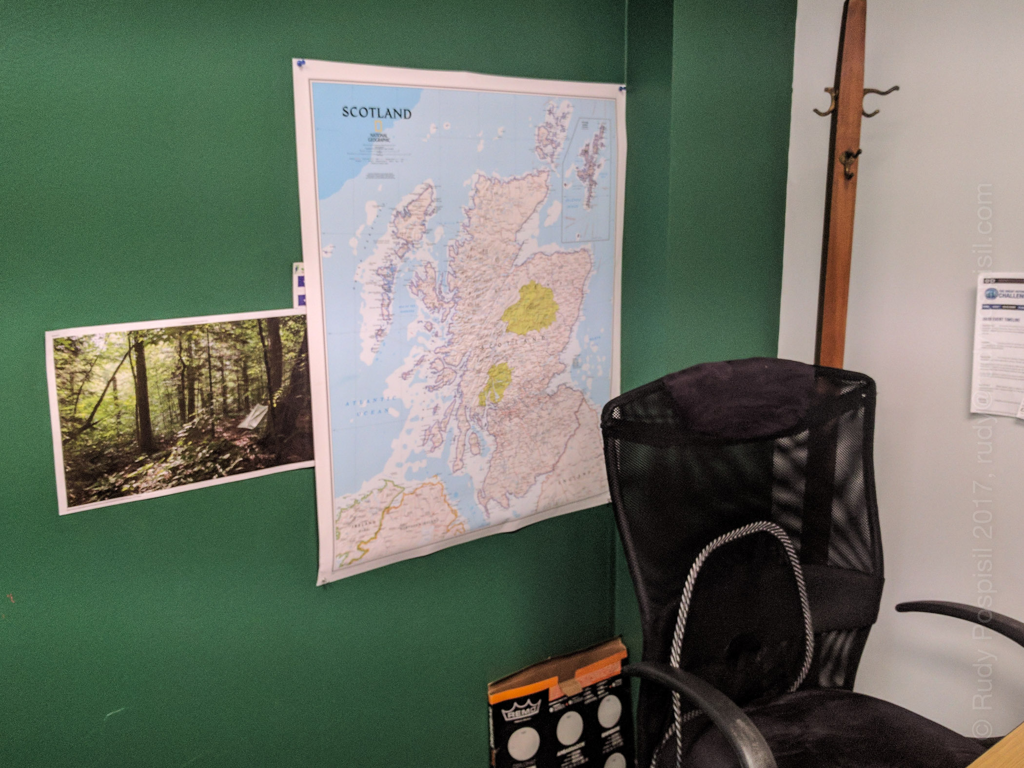
Hanging up a map of Scotland in my office as I begin plans for (hopefully) backpacking across Scotland in the 2018 TGO.

Last year during the month of May, I rode my trusty BMW R1200GS 5,000 miles/ 8,046 kilometers through Canada over the course of 17 days and camped out along the way (Labrador was the best, though I did love Québec).

I loved the journey and it was an amazing experience but it left me wanting to explore more on my own two feet. That led me into backpacking and I’ve been spending a lot of time in the Catskill mountains hiking and camping on the various mountains (see my Catskill 3500 posts).

I spend a lot of time reading blogs for tips and experiences and every once in a while, I come across a photo of someone pitching tent in the Scottish highlands. Nothing is as picturesque as seeing a pitched tent with the rolling Scottish hills in the background. Amazingly beautiful.

As part of my stateside backpacking ventures into the Catskills, I’ve been on the quest to go lighter and lighter in order to allow me to go further and enjoy my trips better. This quest brought me to Zpacks and I’ve fallen in love with their products. A couple weeks ago, I surfed around other parts of their site, notably the “Adventures” section. Here I read about Joe’s TGO trek in 2010. I was immediately hooked by the thought. Entralled, I tell you.

Hanging up a map of Scotland in my office as I begin plans for (hopefully) backpacking across Scotland in the 2018 TGO.

Fast forward… much Googling… reading many blogs of past TGOs… WOW!!! I’m hooked! Backpacking from the west coast to the east coast of one of the most picturesque lands in the world (Scotland, in case you’re not paying attention). Sign me up!

So yeah. This is my planned vacation for next year – the last two weeks in May. Per protocol, I have to submit an application to the The Great Outdoors magazine starting September 15 and I think that I won’t know if I’m accepted until November. Not sure, either all the literature is a bit fuzzy or I’m just not reading it correctly.

This is COMPLETELY up my alley. I’m going for it. Fingers crossed I’m accepted. I’ve hung up a map of Scotland in my office, so now all my co-workers think I’m crazy. Actually, I ride my motorcycle every day, including winter, so they already think I’m crazy. This is nothing new.

In terms of physical preparedness, I backpack most weekends, with the goal of adding summits to my Catskill 3500 list, but I’m stepping up and throwing in 24 mile New York urban hikes. The TGO trek will be, give or take, 200 miles. This equates to a minimum of 15 miles a day for 14 days straight. That’s one thing if it were on level ground in wonderful weather, but it’s going to be in up and down terrain in quite possibly miserable weather. Much more strenuous. Gotta prepare.

Regardless, it’s going to be a lifetime experience, one that I will cherish. Stay tuned. I will post as I prepare.

Visit the official TGO website for information if you’re interested.

Catskill 3500, #13. Twin Mountain

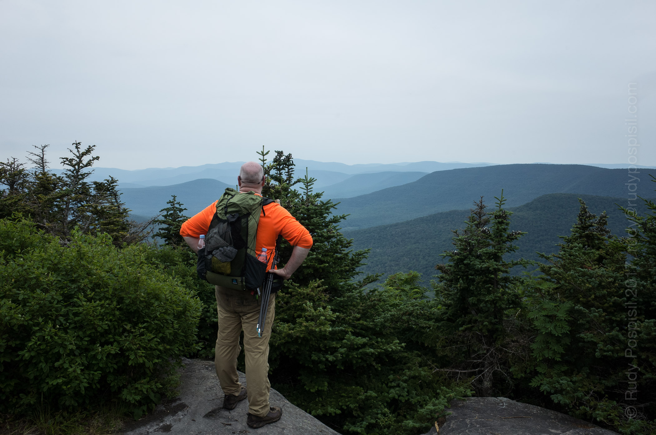
Your's Truly, looking out over the Catskills from the lower summit of Twin Mountain.

Okay. I’m on number 13, lucky 13. I (overly optimistically) thought that I could tackle Twin back in June when I climbed Indian Head but that was dumb. When I got to the trailhead of Twin after descending Indian Head, my legs were butter. Maybe next time.

Okay. It’s next time. This weekend I added Twin to my list. I left Manhattan later than planned and arrived at the Prediger Road DEC parking lot around 1:00PM, much later than I wanted. I had pulled into Tannersville to gas up and realized that I had a flat tire. I located some Fix-a-Flat and that seemed to solve the problem though I knew that I would need to replace the tire as soon as I returned home.

Twin Mountain in the Catskills as seen from the road. Twin is the two summits on the right.
Twin Mountain in the Catskills as seen from the road. Twin is the two summits on the right. Indian Head is on the left (notice how it looks like a face?).
Riding the dirt road to the DEC Prediger Road parking lot.
The Jimmy Dolan Notch Trail trailhead to take you to Indian Head and Twin mountains.

The initial hike on the blue blazed Jimmy Dolan Notch trail was nice and calm, ie flat. After a mile or so, that changed and the ascent became quite challenging. The funny thing, I descended this way last weekend from Indian Head and it didn’t seem so vertical. Did I mention that it was yet another humid weekend up in the Catskills? Not as bad as the previous few weekends but still extremely sweaty. Bugs, however, were much less abundant this go-around though I did get a few Zika bites.

Starting out on the Jimmy Dolan Notch trail from the DEC Prediger Road parking lot.
I've never seen a mushroom as bright and cheery as this.
I’ve never seen a mushroom as bright and cheery as this.
The trek became steep after the initial calmness on the Jimmy Dolan Notch trail.
More steepness (and rocks) on the Jimmy Dolan Notch trail.

Topping out gave way to a small clearing and gave a bit of a reprieve in terms of climbing. The Devil’s Path intersected here. Though the Jimmy Dolan Notch trail technically ended, you could continue north off trail for a 100 feet or so and get a nice view from the actual Notch.

The actual Jimmy Dolan Notch. The view is a bit hindered.

I went right on the red blazed Devil’s Path to ascend Twin (going left would take you to Indian Head). The climb became immediately quite steep again. It was grueling all the way to the first of Twin’s two summits. This first one is the lower one, so don’t get fooled into thinking that you’ve peaked. It’s easy to think this because the view is spectacular, right up there with Giant Ledge.

It's a steep climb - approaching the lower summit of Twin Mountain from the east side.
It’s a steep climb – approaching the lower summit of Twin Mountain from the east side.
It's a steep climb - approaching the lower summit of Twin Mountain from the east side.
It’s a steep climb – approaching the lower summit of Twin Mountain from the east side.
Hitting the 3,500 foot mark as I'm approaching the lower summit of Twin Mountain from the east side.
Hitting the 3,500 foot mark as I’m approaching the lower summit of Twin Mountain from the east side.
Yours Truly, looking out over the Catskills from the lower summit of Twin Mountain.
A gorgeous view from the lower summit of Twin Mountain.

Heading over to the second, and official, summit consisted of a bit of a drop and then back up but it was short and not too difficult. Again, spectacular views. At this point, I took off my pack, sat down, rested my feet, and soaked in the scenery for a good 1/2 hour. Beautiful!

The view from the top of Twin Mountain.
I sat down to soak in the view from the top of Twin Mountain. Taking off my shoes, I noticed a cigarette butt. I was stunned that someone would do this. I went ahead and packed it out with my empty energy bar wrappers.

Heading back down, I made a rookie mistake and headed on to Sugarloaf. It took me approximately 20 minutes for me to realize my mistake. I was having to descend down some serious verticals and trying to remember if they had been so difficult going up. I pulled out my compass (which I should have done much sooner) and saw that I was heading west when I should be going east. Oops. I had to turn around and climb up all of the rock cliffs that I had just climbed down. To add to the misery, it started sprinkling and now I’d have slippery rocks to contend with but luckily it never rained past a slight sprinkling.

I don't remember having climbed up this.
I don’t remember having climbed up this.
I don't remember passing this. I then realized that I was heading to Sugarloaf. Time to turn back.
I don’t remember passing this. I then realized that I was heading to Sugarloaf. Time to turn back.
Here's where I made my mistake when leaving the summit of Twin. The trail on the left goes back to Jimmy Dolan Notch. The trail on the right goes to Sugarloaf. It's easy to think that it's simply one trail wrapping around the trees.
Here’s where I made my mistake when leaving the summit of Twin. The trail on the left goes back to Jimmy Dolan Notch. The trail on the right goes to Sugarloaf. It’s easy to think that it’s simply one trail wrapping around the trees.

Now that I was heading in the correct direction, I hoofed it all the way back down to the level portion of the Jimmy Dolan Notch trail and set up camp for the night. I pitched the tent, hung the bear bag, and promptly fell soundly asleep. I woke up once around 2:00AM and it was eerily quiet, so much so that I could hear a dead twig hitting the forest floor several hundred feet away.

Setting up the Zpacks Duplex on a nice soft forest floor. The bear bag is off to the left, out of frame.

The next morning, I packed up and hiked the remaining mile or so back to the DEC parking lot. The front tire of the motorcycle was holding up nicely thanks to the Fix-a-Flat. Unfortunately, riding out on the dirt road stressed the tire and it began to go flat again. I didn’t have my plug kit and nothing was open on Sunday mornings, so I made the calculated risk to ride home, checking the tire every so often. I went slow and made it home. The rim looks good. The bike is going into the shop for a new set of tires and a rim inspection. I’ll let you know how that goes.

Filling up with some wonderful, cold spring water. I've stopped carrying my Sawyer filter. I find that the BeFree is so much more convenient.
Filling up with some wonderful, cold spring water. I’ve stopped carrying my Sawyer filter. I find that the BeFree is so much more convenient.
Passing a cairn as I'm approaching the DEC parking lot on Prediger Road.
Passing a cairn as I’m approaching the DEC parking lot on Prediger Road.
The elevation graph from my Garmin GPS showing my ascent of Twin Mountain from the east.
The Google Earth map showing my ascent and descent of Twin Mountain from the east.
Home, with a flat tire.

Catskill 3500, #11 and #12. Big Indian and Fir Mountains

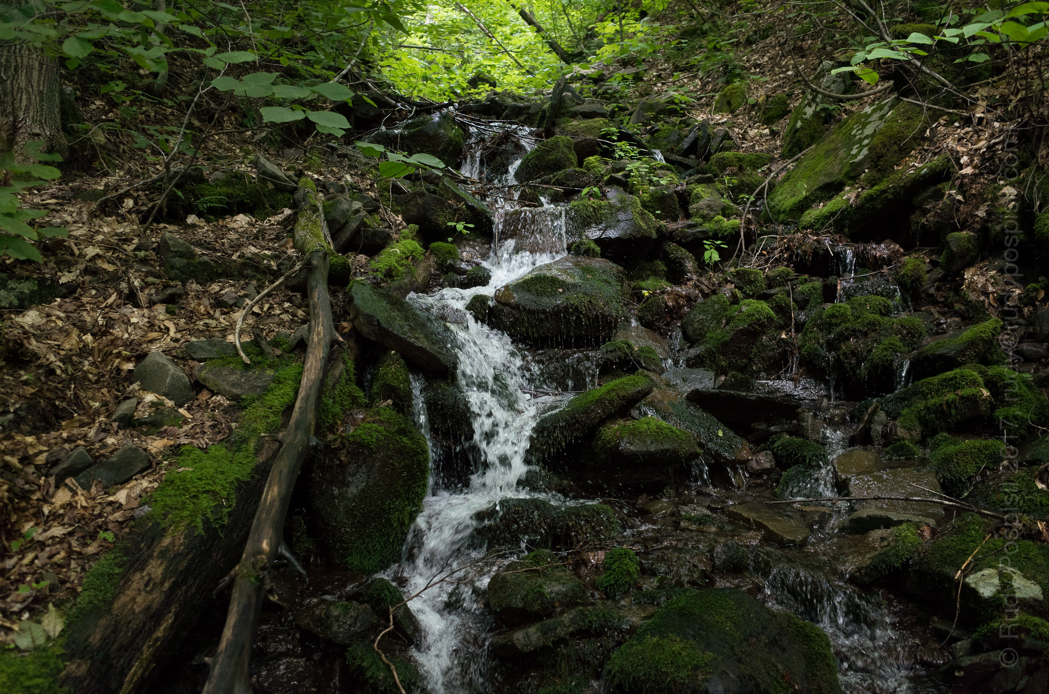
A Biscuit Brook waterfall.

This past weekend I decided to knock off two bushwhacks from my Catskill 3500 list. The plan was to backpack up to the summit of Big Indian, cross over east to Fir, and then back down.

I was excited to get away from the humidity of NYC but unfortunately, it was incredibly humid up in the Catskills. I never felt it cool down the whole ride up. Not a good sign.

Upon arriving at the Biscuit Brook DEC parking lot, I de-suited, switched into my hiking clothes, saddled up the backpack, and headed up the road to the Pine Hill West Branch trailhead. Yep, it was super humid. Within 15 minutes, I was drenched in sweat and it was like this the entire trip. Lots of black flies, gnats, and mosquitos also.

Rain was in the forecast, so I wrapped up the backpack in a waterproof trash bag.
Arriving at the DEC Biscuit Brook parking lot. There's a convenient porta-potty for last minute necessities.
Arriving at the DEC Biscuit Brook parking lot. There’s a convenient porta-potty for last minute necessities.
It's a short jaunt up the ride to the blue blazed Pine Hill West Branch trailhead.
It’s a short jaunt up the ride to the blue blazed Pine Hill West Branch trailhead.
The Register Box at the blue blazed Pine Hill West Branch trailhead.
The first two miles of the Pine Hill West Branch trail is a fairly gentle uphill climb.
The day was incredibly humid, you can see the moisture hanging in the air.
One of many stream crossings on the Pine Hill West Branch trail.
There were a few steep sections along the Pine Hill West Branch trail.
Water was extremely plentiful for the initial 4.5 miles of the Pine Hill West Branch trail.
The 3500 foot elevation marker on the Pine Hill West Branch trail.

My first destination was the summit of Big Indian Mountain. Technically, it is a bushwhack but coming from Biscuit Brook, 99% of the approach is along the blue blazed trail. A herd path branches off about 4.5 miles past the trailhead and goes off for, at most, 1/4 mile before reaching the summit. I can’t imagine an easier bushwhack.

A herd path suddenly appears that'll take one to the summit of Big Indian Mountain.
A herd path suddenly appears that’ll take one to the summit of Big Indian Mountain.
The herd path to the summit of Big Indian is very well defined and very short, only about 1/4 mile.
Success! Signing in at the Big Indian Mountain gray bushwhack canister.

From there, I continued my journey east towards Fir Mountain. Now began the true bushwhack. The herd path quickly disappeared and I had to rely on my compass to ensure that I was moving in the correct direction. The plan was to make it to the low point where Big Indian and Fir met, and set up camp for the night. Unfortunately, thunder quickly rolled in as I started down Big Indian. A major thunderstorm appeared to be looming. I didn’t want to get caught in it and since I was planning on setting camp soon, I decided to stop and drop. I was on some level ground and wasn’t sure that I’d have better options until the valley which would require me backpacking through the storm.

A herd path going off in the direction of Fir Mountain.

Space was very tight and the stakes wouldn’t bite due to the ground being all leaves, but I got the ZPacks Duplex pitched. I hung the bear bag and my sweat drenched clothes and retired for the night just as the rain picked up.

Setting up camp for the night with the ZPacks Duplex.
Hanging the bear bag to keep all food out of the tent for the night.
A closeup of my homemade waterproof cuben fiber bear bag. No, this is not how I hung it for the night.

Bright and early the next morning, I packed up and headed over to Fir Mountain. Using my compass, I tried to still upon the Catskill Divide ridge as best as possible as it links the two summits. This was a true bushwhack. Every great once in a while, I would come upon a herd path but it never lasted long. The majority of the trip involved pushing through deep brush, thick tree layers, and jockeying over rock ledges. At one point, I fell down into a gully trying to jump across a ravine and had to administer some minor first aid.

Sunday morning. Time to pack up and head east to Fir Mountain.
Bushwhacking through some tough terrain on the way to the summit of Fir Mountain.
Every great once in a while, a herd path would appear. These were very short and very infrequent.
Bushwhacking through some dense foliage.

It was slow going but I made it to the Fir Mountain gray canister around 12:30pm. It was tricky to find but you have to just keep going up. One thing to note is that there were no water sources. The day before was abundant but not today.

Bushwhack success!!! Signing in at the gray canister at the summit of Fir Mountain.

After a short rest and requisite photography, I began the descent back to the parking lot. The plan was to go south west until intersecting the Pine Hill West Branch trail near the shelter and then take the blazed trail back to the bike. I followed the herd path leading from the summit for perhaps a half hour but then it disappeared. I was now back to bushwhacking and a noticeable decline in pace.

Encountering a deer as I'm heading south down Fir Mountain.
Encountering a deer as I’m heading south down Fir Mountain.
Coming upon Biscuit Brook. This was a bit of a precarious crossing.

The descent was steep and long. After a few hours, I came upon a brook and filled up with fresh water. I moved further down and waded across Biscuit Brook and on to the Pine Hill trail. From there, it was two miles back to the bike.

A Biscuit Brook waterfall.
Intersecting with the Pine Hill West Branch trail after bushwhacking down Fir Mountain.
Heading back on the Pine Hill West Branch trail to the Biscuit Brook DEC parking lot.

Sunday was a tough day. It took me approximately 11 hours to bushwhack from Big Indian to Fir to the parking lot. Very slow going but exhilarating, nonetheless. I switched out of my drenched clothes and into my bike gear, and headed home excited about the shower soon to be had.

The Register Box is a beautiful sight at the end of two long days of backpacking and bushwhacking.
The elevation graph of my trek up and down Big Indian and Fir Mountains in the Catskills.
My trek up and down Big Indian and Fir Mountains in the Catskills according to Google Earth.