I thought I’d post about this as others may have run into this issue and not finding the right information about resolving it. We spent a lot of time googling to no avail.
In anticipation of our largest traffic spike of the year, we ran a load test using Load Impact, a third-party service that bombards your website with virtual users as a means of testing how your servers handle an influx of increasing traffic. For a small fee, of course.
We began a test of 800 VUs over the course of a 1/2 hour and began seeing the following error (ASP.NET):
There was an error

SITE ERROR TYPE: System.InvalidOperationException [500] Error Message: The page is performing an async postback but the ScriptManager.SupportsPartialRendering property is set to false. Ensure that the property is set to true during an async postback. URL:https://www.foo.com/foo USER AGENT:LoadImpactRload/3.2.0 (Load Impact; http://loadimpact.com); REFERRER: Error Stack: at System.Web.UI.ScriptManager.OnPageInitComplete(Object sender, EventArgs e) at System.Web.UI.Page.OnInitComplete(EventArgs e) at System.Web.UI.Page.ProcessRequestMain(Boolean includeStagesBeforeAsyncPoint, Boolean includeStagesAfterAsyncPoint)
This error came with every request and eventually the server choked. Figuring that we uncovered some major bug, we took to googling, finding fixes from simple to complicated. The thing is, looking back in our error logs, we’ve only seen this error a few times in real life and even then, only coming from some mobile devices. So, we deduced that this error was triggered by Load Impact itself. Sure enough, we changed the user agent, re-ran the tests, and the errors disappeared.
The Load Impact tests default to Load Impact as the user agent. You can change this via the Advanced Settings in the portal or you can add a line at the top of your scripts. Chrome on Windows is, by far, the most popular browser used to visit our website, so we added:
http.set_user_agent_string("Mozilla/5.0 (Windows NT 6.1) AppleWebKit/537.36 (KHTML, like Gecko) Chrome/41.0.2228.0 Safari/537.36")
Easy peasy, no more errors. Hope this fixes your problem.
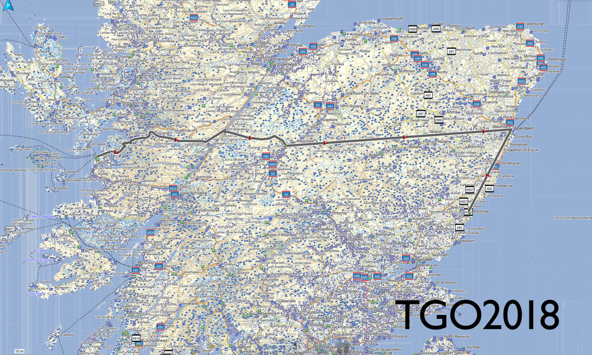
Happy Days!!! I received word that I’m in – I made the cut and I’m eligible for the 2018 TGO (The Great Outdoors) Challenge, a coast to coast Scotland backpacking adventure.
Acceptance email for TGO Challenge 2018, backpacking Scotland coast to coast.
I just sent in my entry fee to make it official and now I have to plan out my route to present to the TGO Challenge vetters. For those who don’t know, the TGO Challenge, in its 39th year, is a self-sustained backpacking trip from the west coast of Scotland to the east coast. Scotland is very unique in that they allow for “wild camping” on most outdoor private and public land and the culture is very accepting of this (unlike here in the States where you’d probably get shot as a trespasser).
So, now I begin the planning. I’m in the infancy stage but my initial thoughts are to:
1. Fly into Glasgow
2. Take a train to Mallaig and sign in
3. Take a ferry to Inverie
4. Backpack several days over to Loch Ness (gotta check out Nessie)
5. Backpack down to Newtonmore, stay in a hostel and have a nice shower
6. Backpack several days over to Aberdeen
7. Take a bus down to Montrose and sign out
Averaging 15 miles a day, this will take me approximately 12+ days to complete. That should allow me an extra day in Aberdeen and an extra day in Montrose if all goes well.
It’s Wednesday morning. I woke up to rain again. It’s a bit annoying for the simple matter that wet gear and wet clothes are no fun. I suppose that simply adds to the challenge and it has been a challenge. Three bushwhack peaks now bagged. Let me take advantage of the rain and use the time to bring you up to date.
I arrived at the DEC Denning parking lot on Saturday, September 2 around 3:00pm – later than originally planned. Speaking of plan, the plan was to backpack in along the Neversink River using the Fisherman’s Path (a herd path), camp, and fill up with water at the base of the col between Friday and Balsam Cap, bag them the following day then camp in the col of Balsam Cap and Rocky, bag Rocky and Lone the following day, camp out and finally on Wednesday, hike back to the bike and head home.
Well, it’s Wednesday morning, it’s pouring outside, and I’m sitting in a tent in between Rocky and Lone, well off plan.
I packed away my motorcycle gear, donned my backpacker persona, and headed in. The hike starts on the Trail, a path nestled within private land. It’s only 1.2 miles and extremely easy (ie, flat). At its end and where the … trailhead begins is a primitive camp. It’s also where the Fisherman’s Path begins, marked by a makeshift cairn. This is what I was looking for. The path would take me to the point where I would begin my climb up to the first of the bushwhack climbs, Friday.
I fumbled around the primitive camp site (there were three) a bit trying to orient myself and locate the path. After five-ten minutes, I happily noticed a cairn marking a well-trodden herd path heading ENE – this must be the place.
The Fisherman’s Path heads east and follows along the south side of the Neversink River and provides not only beautiful sights but also a constant source of refreshing water – no need to ration.
The path is fairly well worn but easy to lose from time to time as your attention strays. This happened to me when the path crossed the river without me realizing it and I found myself traversing up a steep slope. At this point it was nearing dusk and I needed to set up camp for the night. The steep side of a mountain wasn’t going to work. I came upon a gully and took it back down a hundred feet or so. I found a flat spot but being at the bottom of the slope that I had just climbed down and knowing that rain was in the forecast, this caused concern. I could easily find myself waking to a waterfall streaming into my tent in the middle of the night.
I looked across the Neversink and saw a few potential campsites. In fact all the while I had been hiking, I noticed many times what appeared to be a herd path along the northern shore.
Crossing the river across the myriad of stones available, I alit on the north shore. Within a few minutes I located a nice spot making sure that I was a minimum 50 paces away from the river. I set up the tent, hung the bear bags (one containing six days of food, the other my cookset), and retired. I wasn’t hungry and decided to wait and eat in the morning.
Then the rain started and except for a few momentary respites, didn’t stop for 22 hours, from approximately 7:00pm Saturday till 3:00pm Sunday. Heavy and relentless. I didn’t deem it safe for me to venture out on a bushwhack during a torrential rainstorm, not to mention how miserable I would be, so I opted to wait it out in the tent. It was boring. I slept and read but I was dry. At one point around 10:00am, the rain let up as it had done a few times before (and then promptly started up with gusto). I went to check on the bear bags. I had heard a thud during the night and was worried they had fallen. They were fine. The sky wasn’t clearing up so I expected the rain to return. I reached up to pull them down (hung via the PCT method) to grab some food bars and sure enough the rains started back up.
Not wanting to get in the tent with soaking wet clothes (call me no fun), I stopped and quickly ran back. Just as I zipped the door closed, the rains kicked into overdrive. The day officially became a zero. Not in my plans. When the downpour finally ended at 3:00pm, it was too late to pack up and head out. Sure, I could get in a few hours of travel time before having to set camp but I didn’t know where this would land me. I would be completely off trail in unknown rugged backcountry and felt safer to fresh in the morning. Additionally, the rain would have soaked in allowing for much safer footing. Looking back, I suppose I could have done a Skurka and simply battled it out, but I was on vacation and wanted to have fun and be safe. No worries, though, as you’ll see that I ended up taking this approach at a later date in the trip.
Monday arrives. I ponder whether I’ve ever slept as much in a 24 hour period. Probably only when I’ve been sick.
[to be continued…]
The DEC Denning parking lot where my trusty BMW R1200GS sat for a week, waiting for me to return.Signing in at the Register at the trailhead of the East Phoenicia Branch trail in the Slide Mountain Wilderness of the Catskills.The East Phoenicia Branch trail in the Slide Mountain Wilderness of the Catskills.The cairn marking the trailhead of the Fisherman’s Path.Hiking on the Fisherman’s Path along the Neversink River.Camping near the Fisherman’s Path along the Neversink River.Enjoying the view while having breakfast on Monday morning.Filling up with water to ensure I have enough for the ensuing four mountain bushwhack.Finding my way over to the Catskill Divide between Friday and Balsam Cap Mountains.Finding my way over to the Catskill Divide between Friday and Balsam Cap Mountains.One of numerous obstacles I encountered on my way over to the Catskill Divide between Friday and Balsam Cap Mountains.Making my way to the Catskill Divide between Friday and Balsam Cap Mountains.Taking pack off and resting on the Catskill Divide between Friday and Balsam Cap Mountains.Making my way up to Friday along the Catskill Divide ridge line. I believe that’s Panther in the background.Making my way up to Friday along the Catskill Divide ridge line.A massive rock standing between me and the Friday peak.Hoofing up the southern side of Friday Mountain.Panther and Cornell as seen on the way to the peak of Friday Mountain.Pushing past fallen trees along the Catskill Divide ridge along on the way to Balsam Cap.Another rainy night. Camping out below the Catskill Divide ridgeline in the col between Friday and Balsam Cap.Making my way up to the peak of Balsam Cap.Ashokan Reservoir as seen from the Catskill Divide ridge line on Balsam Cap.Your’s truly bagging the grey canister on Balsam Cap.Steep rocks to climb on the way up Rocky Mountain.Massive uprooting on Rocky Mountain.Caught in a hailstorm near the peak of Rocky Mountain.Yours’ truly bagging the grey canister on the peak of Rocky Mountain.The view on the way to Lone Mountain.Traversing the flat col between Rocky and Lone was offset by the serious amount of “blow down”.Traversing the flat col between Rocky and Lone was offset by the serious amount of “blow down”.The opportunities to skewer myself were great, indeed.A tight squeeze on Lone Mountain.I should have brought my lawn mower. I’ve never lush grass like this before on a Catskill mountain.Yet more dense blow down to push through. It was relentless.Yours’ truly bagging the grey canister on the peak of Lone Mountain.Heading back down from Lone Mountain to Neversink River.Finally. Water to replenish my supply. It’s a bit brown from the previous several days of hard rain.Camping out along the southern side of the Neversink River as I make my way back home.The heavy rains made it very difficult to keep track of the Fisherman’s Path herd path.Crossing the foot bridge along the Peekamoose-Table blue-blazed trail.Arriving back at the DEC Denning parking lot and the BMW R1200GS, six days later.Garmin GPS elevation graph of my roundtrip Friday-Balsam Cap-Rocky-Lone bushwhack.Google Earth map of my roundtrip Friday-Balsam Cap-Rocky-Lone bushwhack.Topo map showing my roundtrip Friday-Balsam Cap-Rocky-Lone bushwhack.NY/NJ Trail Conference map showing the “Bushwhack Range”.
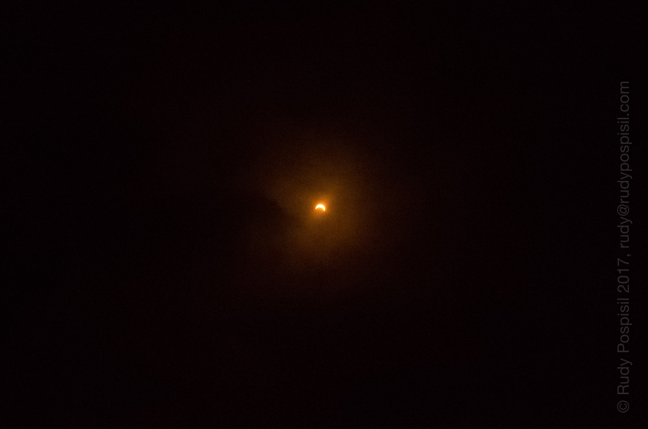
Here are some pics from yesterday’s eclipse, taken at work from the Pantone parking lot in Carlstadt, NJ.
Pantone co-workers enjoying the eclipse.Eclipse over New Jersey, 2017.Eclipse over New Jersey, 2017.Eclipse over New Jersey, 2017.Eclipse over New Jersey, 2017.Eclipse over New Jersey, 2017.
Work’s been a bit grueling. My boss offered me Friday off which I gladly accepted and turned it into a three day Catskill weekend. The plan was to ride up on Friday morning, climb up Eagle Mountain and camp out on Haynes Mountain. Saturday, I would bag Balsam and then trek back over Haynes and Eagle and camp out near the Shandaken shelter. This would give me #14 and #15 on my Catskill 3500 list. Sunday would be a nice leisurely trek back to the bike and (sniff) back to Manhattan.
The forecast called for lots of rain over the weekend. It was raining pretty hard first thing Friday morning, so I waited it out until it stopped around 9:30am. This was good timing as it got me on the road after rush hour. Anyone who’s taken 17 during rush hour knows what a horrible experience that can be.
I arrived at the empty Seager Road DEC overnight parking lot around noon. It barely sprinkled during my ride up. I was worried that I’d have to pack up my motorcycle gear wet – fortunately this wasn’t the case.
Parking at the Seager DEC overnight lot and trailhead for the Seager-Big Indian trail.
I mapped out taking the yellow-blazed Seager-Big Indian Trail (SBI) to the blue-blazed Pine Hill West Branch Trail (PHWB). The first two miles of the SBI trail are actually through private land. The owner has been gracious enough to allow hikers to pass through on the sanctioned trail but anything outside the trail is private and not to be trespassed on, nor is any camping allowed. The path crosses the Shandaken Brook a few times, so there is plenty of opportunity to fill up with cool stream water. Make sure to follow the yellow blazes and make sure to keep an eye on them. There are a lot of trails branching off but these are private jeep paths.
Backpacking through the private land portion of the Seager Big Indian trail. The Shandaken Brook runs the length of it, so plenty of water to drink.
Once past the two mile mark, the land becomes public and is marked as such. Shortly past this is the Shandaken Shelter, poised right on the bank of the Shandaken Brook. I was actually quite surprised that the DEC has a shelter directly on the water. Anyway, be warned that this was the last water source until I returned.
Entering the official public DEC-managed land.The Shandaken shelter, right on the Shandaken Brook, two miles out from the Seager parking lot.
From the shelter, it was a mile before hitting the junction for the blue-blazed PHWB trail. It started drizzling but nothing that warranted wearing any rain gear. I took a louie and headed north up Eagle Mountain, and the rains came. It began coming down hard. I recently purchased a Snow Peak ultralight hiking umbrella and this provided a perfect opportunity to give it a go. I don’t like hiking in rain gear because it never breathes well and it just makes me sweat, so I thought that the open air ventilation of an umbrella might do the trick. It did, however I immediately realized that using the trekking poles was no longer viable. Maybe an umbrella hat, ha ha.
The rains came. I pulled out a Snow Peak ultralight umbrella and kept dry for the most part. It was much easier than stopping, taking off the pack, and putting on rain gear, not to mention that I would then start getting clammy.
Reaching the summit of Eagle Mountain was a bit steep at times but nothing outrageous. As you near the peak, there is a short herd path that heads west of the SBI trail and takes you to a large cairn, an obvious marking of the peak.
The 3,500 ft elevation marker on the south side of Eagle Mountain.The cairn marking the peak of Eagle Mountain in the Catskills.
Ahh, #14. Unfortunately, there was no view whatsoever. I was planning on using the occasion to boil some water and cook up some dehydrated Chana Masala. In bear country, it’s always best to cook any food far before you reach campsite. However, I pulled a Reese Witherspoon/”Wild” – I forgot my flint (she bought the wrong fuel). So, I ate a meal bar, took my photographs of the cairn, and continued the trek north towards Balsam. This would take me over Haynes Mountain which, at 3420 feet, is too short to be a Catskill 3500er. As such, however, it’s legal to camp at the peak which was my plan.
Heading up and over Haynes Mountain on the way to Balsam Mountain.
Reaching the top of Haynes, I realized that there weren’t any good camping options. The peak was lush with vegetation, along with being riddled with rocks and fallen trees. I scurried down the north side of Haynes and soon found a very favorable bare, level spot surrounded by trees and ground covering. It was quite serene and exactly the kind of spot I love to set up in. Nature at its lushest. The rain had stopped a while ago and I was able to pitch in the dry. I had about a liter of water left but no worries as my plan was to fill up at the designated water source marked on the NY-NJ Trails map. I hung the bear bag, laid out my wet clothes, and was sawing logs by 7:00pm.
Waking up Saturday morning in my trusty Zpacks Duplex tent on the north side Haynes Mountain.
I got in a good 12 hours of slept, my body was happy. I woke up 7:00am, packed up, and headed northeast to Balsam, approximately 1.5 miles away. Nothing eventful, just a steady, rocky incline to the top. Again, no view, just a makeshift cairn. The NY-NJ Trails map showed a “starred scenic view” a bit north of the peak, so I decided to take a look. Wow! I was taken aback by the view, it was truly mesmerizing. I sat there for an hour and soaked in the view and the sunshine. I also took the opportunity to take off my shoes and socks and see if I could get them to dry out a bit.
The cairn marking the peak of Balsam Mountain.Yours truly, breath taken away, overlooking the Slide Mountain and the Hunter-West Kill Mountain Wilderness from the top of Balsam Mountain in the Catskill Mountain Range in upstate New York.Panorama overlooking the Slide Mountain Wilderness and the Hunter-West Kill Mountain Wilderness areas from the top of Balsam Mountain in the Catskill Mountain Range in upstate New York.Drying out the trail runners. The Oboz have been giving me hot spots. After a lot of research, I’m trying a pair of Hoka Oné Oné Speed Goat 2 trail runners.
Balsam is one of the required winter peaks, so I’m going to remember this spot and plan on setting up camp on the perch. What an amazing view to wake up to in the white of winter.
The hour passed and I strapped everything back on to begin the trek back to the Shandaken shelter. Down Balsam, up Haynes, down Haynes, up Eagle, down Eagle.
Coming down Balsam, I stopped at the designated water source to fill up but… it was nowhere to be found. There wasn’t even any evidence of one in the past. I had half a liter left. This would need to be rationed over the next 4.5 miles and it was quite humid. I’ll be fine.
As I passed this uprooted tree, I was blasted by hot air which I assumed was energy dissipating from open roots. A very strange feeling.
As I was huffing and puffing back up Eagle, having traversed Haynes, some guy in his 50s comes flying past me. “Come on, this is an easy one.” I hate people like this. I reached the herd path to the peak and figured I’d go in for a second look. The same guy is there, typing into his cell phone. He has absolutely no sweat going on and I’m standing there drenched. Did I mention that I hate these people?
Turning around, I headed down the south side of Eagle Mountain for the last 2.1 miles to the shelter. I arrived around 3:00pm with 2-3 ounces of water left and filled up with glorious Shandaken Brook water. Finding a spot far enough from the shelter and privy, I set up for the night, and eventually dozed off while reading my Kindle. Later in the night proved to be quite eventful. I was awakened by bright LED flashlights scouring the area. There were quite a few people at the shelter and I assumed that one of them must have lost something and a few of them were looking for it. Either that or they were drunk and looking for the loo. The lights eventually subsided and I fell back to sleep, only to be awaken a couple hours later by another bright flashlight, this time someone night hiking through the trail (not a good idea). Oh, and during this time, it rained quite heavily throughout the night. I had pitched my tent underneath some overhanging foliage, so I was spared the brunt of it.
Morning came, I arose, packed out, and hit the trail by 6:30am. It was a nice easy two mile trek back to bike, albeit quite sloggy from the rain the night before. Pack up the bike and back to Manhattan with a recharged soul. Nothing is more invigorating than being off the grid and breathing in pure mountain air for a straight 48 hours. See you on #16.
The trek back to the parking lot was quite muddy and wet due to the rainfall throughout the night.The register box and the BMW R1200GS in the distance. Time to go back to the rat race.Elevation graph showing the ascents of Eagle, Haynes, and Balsam Mountain (with the scenic overlook at the end).Google Earth map showing the roundtrip backpacking trip from Seager to Eagle Mountain to Haynes Mountain to Balsam Mountain and back.
I’ve had a string of bad luck with the bike this year, each time disabling the bike. The starter relay went bad near the beginning of the year. Then in April, the ring antenna fried. I lost another starter relay in May and then June, and then another ring antenna this month.
Well, it turns out that my starter motor has been on the outs for quite a while. I realized this after the second starter relay went bad. I went back in the memory logs and remembered the bike every once in a while having a sluggish time starting. This has been happening since probably last year.
The location of the starter motor of a 2005 BMW R1200GS motorcycle.
Anyway, a faulty starter motor can send too high of an amperage and fry the relay. Now, whether the ring antenna is at the same risk, I don’t know but the timing seems coincidental.
I love eBay. I ordered a used one from Rev It Red in the UK. It was advertised as coming from a 13K mile bike. However, when it arrived, it looked worse than mine and mine has almost 70K miles on it. Furthermore, the positive terminal was stripped internally. The nut was rusted tight and the bolt just spun. No good. Rev It Red refunded my money though I lost out on most of the $40 shipping charge.
Take 2. I ordered another used starter motor, again from a 13K mile bike, but this time from the Georgia eBayer, motowarrior. The part arrived within four days and it was superb. Top notch shape.
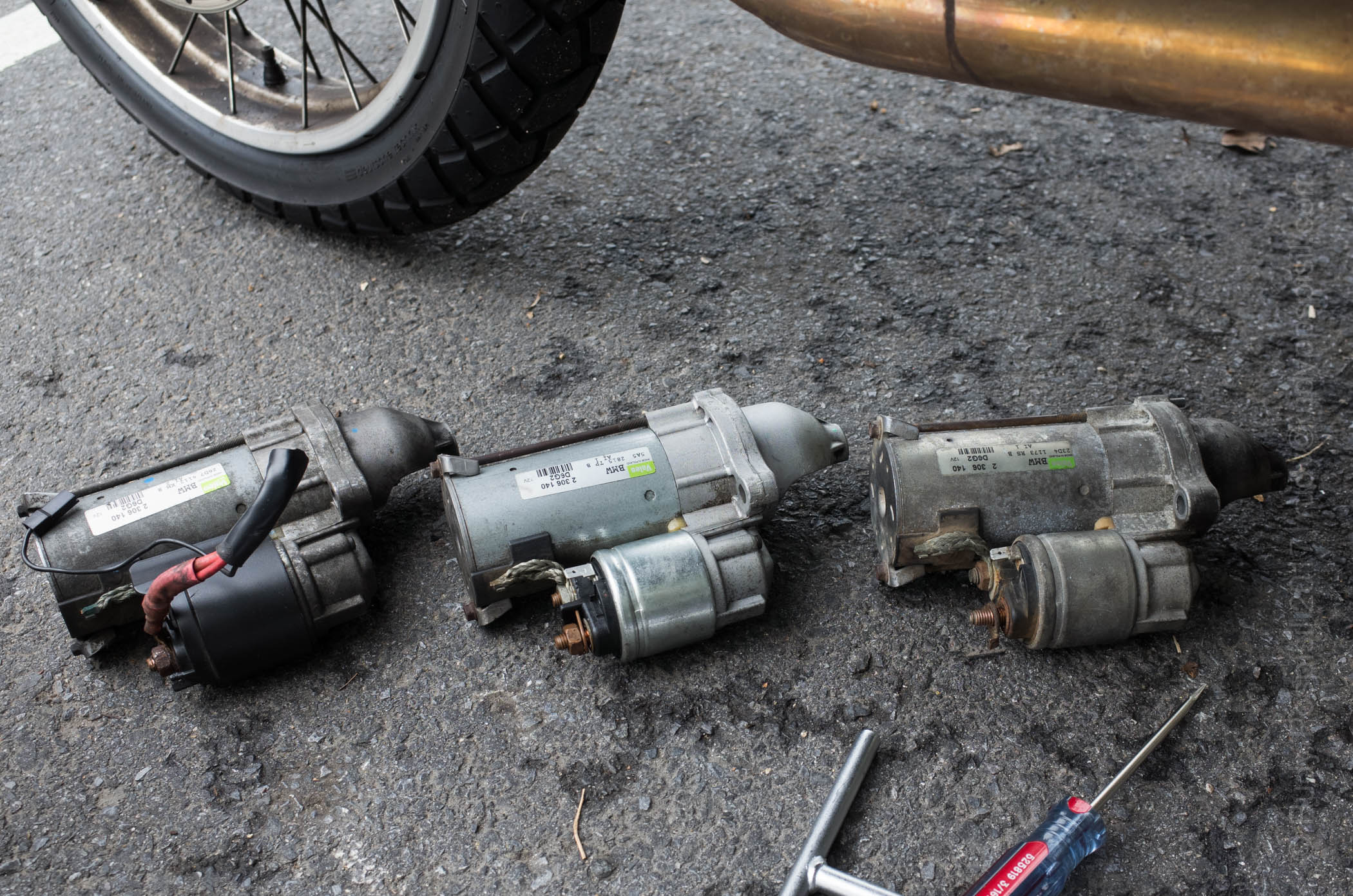
2005 BMW R1200GS Starter Motor Comparison. On the left is the Rev It Red used motor, the middle is the beautiful motowarrior replacement, and on the right is the dying one from my bike.
I installed it today and wow, what a difference.
The bolt on the backside is difficult to get to without removing anything off the bike. I pieced together a T-Wrench, a six-inch extension, and an elbow which yielded success.
You forget how a bad performing part is supposed to perform until you replace it with a good part. The bike is s0o0o0o much happier. I’m sure that I won’t have any more relay problems. The ring antenna, I’m not so sure. I went ahead and ordered a backup in the event it happens to fry again. Fingers crossed it doesn’t.
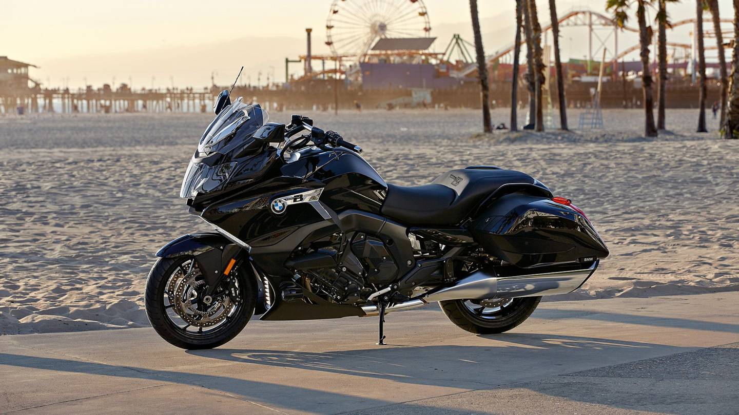
BMW is going after the bagger market. While I have no doubt that it can handle 5,000 mile/17 day trips, for me it looks to be a bit stodgy. I’ll stick with the trusty, nimble R1200GS.
BMW to Offer Test Rides of the K 1600 B Bagger at the Sturgis Motorcycle Rally
Will this German bagger be embraced or rejected by the Sturgis crowd?
BY ERIC BRANDTJULY 20, 2017
BMW has generally always made distinctly European motorcycles. In a sort of break from their bread and butter, the BMW K 1600 B Bagger is a big cruiser designed for touring duty. It was designed to cater to American tastes in motorcycles as an alternative to the more traditional cruisers on the market.
As part of the marketing campaign for the new bike, BMW will be offering demo rides of the big bagger at the Sturgis Motorcycle Rally, reports Motorcycle.com, which attracts some 500,000 riders to a small town in South Dakota with a population of 6,832. The location of the demo is in the nearby town of Buffalo Chip, SD.
The BMW K 1600 B Bagger should be right at home at Sturgis, which mostly attracts big touring bikes that have ridden hundreds or even thousands of miles to be there. This Beemer was made for comfortable, high-tech, long-distance touring.
This bagger is powered by a 1649cc inline-six engine which produces 160 horsepower and 129 ft-lbs of torque. Features include a sleek, modern design with plenty of storage, three driving modes (rain, road, and dynamic), a power adjustable windshield, traction control, and available packages that include extra safety and convenience tech like an adaptive headlight, LED aux lights, and Bluetooth.
Joining the K 1600 B Bagger will be the rest of the BMW Motorrad lineup ,including the C Evolution electric scooter and the all-new entry-level G 310 R. The demos run from Friday, August 4 through Saturday, August 12 from 9 am to 5 pm. If you’re one of the thousands of riders going to Sturgis, throw a leg over this futuristic new cruiser. If you really like it, you’ll be able to get one starting at $19,995, which puts it in the same price range as the Indian Chief, the Harley-Davidson Road King, and the Honda Gold Wing F6B.
Facebook AI Creates Its Own Language In Creepy Preview Of Our Potential Future Tony Bradley, CONTRIBUTOR
Facebook shut down an artificial intelligence engine after developers discovered that the AI had created its own unique language that humans can’t understand. Researchers at the Facebook AI Research Lab (FAIR) found that the chatbots had deviated from the script and were communicating in a new language developed without human input. It is as concerning as it is amazing – simultaneously a glimpse of both the awesome and horrifying potential of AI.
Artificial Intelligence is not sentient—at least not yet. It may be someday, though – or it may approach something close enough to be dangerous. Ray Kurzweil warned years ago about the technological singularity. The Oxford dictionary defines “the singularity” as, “A hypothetical moment in time when artificial intelligence and other technologies have become so advanced that humanity undergoes a dramatic and irreversible change.”
To be clear, we aren’t really talking about whether or not Alexa is eavesdropping on your conversations, or whether Siri knows too much about your calendar and location data. There is a massive difference between a voice-enabled digital assistant and an artificial intelligence. These digital assistant platforms are just glorified web search and basic voice interaction tools. The level of “intelligence” is minimal compared to a true machine learning artificial intelligence. Siri and Alexa can’t hold a candle to IBM’s Watson.
Scientists and tech luminaries, including Elon Musk, Bill Gates, and Steve Wozniak have warned that AI could lead to tragic unforeseen consequences. Eminent physicist Stephen Hawking cautioned in 2014 that AI could mean the end of the human race. “It would take off on its own and re-design itself at an ever increasing rate. Humans, who are limited by slow biological evolution, couldn’t compete, and would be superseded.”
Stephen Hawking. Photo copyright NIKLAS HALLE’N/AFP/Getty Images
Why is this scary? Think SKYNET from Terminator, or WOPR from War Games. Our entire world is wired and connected. An artificial intelligence will eventually figure that out – and figure out how to collaborate and cooperate with other AI systems. Maybe the AI will determine that mankind is a threat, or that mankind is an inefficient waste of resources – conclusions that seems plausible from a purely logical perspective.
Machine learning and artificial intelligence have phenomenal potential to simplify, accelerate, and improve many aspects of our lives. Computers can ingest and process massive quantities of data and extract patterns and useful information at a rate exponentially faster than humans, and that potential is being explored and developed around the world.
I am not saying the sky is falling. I am not saying we need to pull the plug on all machine learning and artificial intelligence and return to a simpler, more Luddite existence. We do need to proceed with caution, though. We need to closely monitor and understand the self-perpetuating evolution of an artificial intelligence, and always maintain some means of disabling it or shutting it down. If the AI is communicating using a language that only the AI knows, we may not even be able to determine why or how it does what it does, and that might not work out well for mankind.
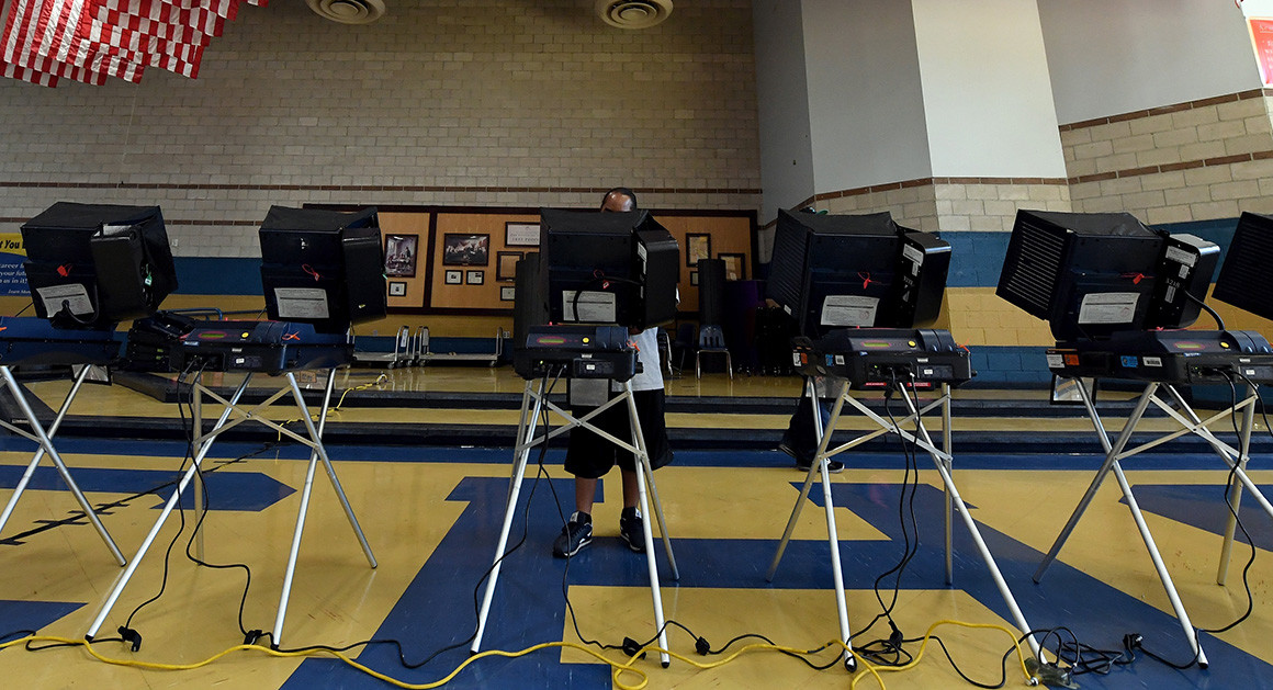
Hackers descend on Las Vegas to expose voting machine flaws
By KEVIN COLLIER 07/30/2017 07:25 AM EDT Updated 07/31/2017 12:24 AM EDT
LAS VEGAS — Election officials and voting machine manufacturers insist that the rites of American democracy are safe from hackers. But people like Carten Schurman need just a few minutes to raise doubts about that claim.
Schurman, a professor of computer science at the University of Copenhagen in Denmark, used a laptop’s Wi-Fi connection Friday to gain access to the type of voting machine that Fairfax County, Virginia, used until just two years ago. Nearby, other would-be hackers took turns trying to poke into a simulated election computer network resembling the one used by Cook County, Illinois.
Elsewhere, a gaggle of hackers went to work on a model still used in parts of seven states, as well as all of the state of Nevada. Though the device was supposedly wiped before it was sold by the government at auction, the hackers were able to uncover the results the machine tallied in 2002.
A voter casts a ballot at a machine at Cheyenne High School on Election Day on Nov. 8, 2016, in North Las Vegas, Nevada. | Ethan Miller/Getty
They were among the hundreds of cybersecurity experts who descended on “Voting Village,” one of the most talked-about features of the annual DEF CON hacker conference. In a cramped conference room, they took turns over three days cracking into 10 examples of voting machines and voter registration systems — a reminder, they say, of the risks awaiting upcoming U.S. elections.
“I could have done this in 2004,” said Schurman, who could gain administrative-level access to the voting machine, giving him the power to see all the votes cast on the device and to manipulate or delete vote totals. “Or 2008, or 2012.”
Anne-Marie Hwang, an intern at the digital security firm Synac, demonstrated that by bringing a generic plastic key to mimic the ones given to poll workers and plugging in a keyboard, she could simply hit control-alt-delete and enter the voting machine’s generic password to gain administrative access.
The lesson: “The bad guys can get in,” said Jake Braun, a panel moderator at the conference who advised the Department of Homeland Security on cybersecurity during the Obama administration.
And that means election officials must acknowledge that no security is foolproof. Instead, Braun said, they need to adopt the private sector model of working to better detect and minimize the effect of successful cyberattacks rather than trying to become impenetrable.
“‘Unhackable’ is absurd on its face,” Braun said. “If the Russians and Chinese and whoever else can get into NSA and Lockheed Martin and JP Morgan, they absolutely can get into Kalamazoo County or the state of Ohio or the [voting machine] vendor.”
Already, the country has seen Moscow-backed hackers attack the 2016 U.S. election in what intelligence officials said was a widespread digital meddling campaign orchestrated by Russian President Vladimir Putin. According to U.S. officials, the Kremlin’s digital spies targeted at least 21 state voter registration systems and successfully infiltrated at least two, Arizona and Illinois. On Election Day, the White House staff was so worried about Russian hackers tampering with the actual voting process that it drew up a 15-page contingency plan that included potentially deploying the military and National Guard.
But Nov. 8 came and went with no indication that any votes were altered, a point U.S. officials stress regularly. Voting security experts caution, though, that the country doesn’t have the mechanisms in place to make such a definitive conclusion.
“One thing that’s been very unfortunate in the way a lot of election officials have talked about the breaches is saying the phrase we have no evidence that X, Y, or Z happened,” Braun added. “However, the real answer is they have no idea what happened, or [way] of knowing. I’m not suggesting votes were switched or voters were deleted from voter files, but the point is the security is so lax and so bad that they have no way of going back and doing the forensics and saying one way or the other.”
Federal and state officials argue that it would be extremely unlikely for hackers to manipulate vote tallies. Voting machines are not connected to the internet and many states collect voter registration information at the county level, providing a backup to confirm the veracity of the statewide database. Basically, the system is decentralized and lacks key internet links, they say.
Before the 2016 election, former FBI Director James Comey assuaged fears by telling Congress that the system was so “clunky” — comprised of a mishmash of different kinds of machines and networks, with each state’s results managed by a consortium of state and county officials — that its overall integrity was fairly safe.
Election security advocates aren’t as confident. Barbara Simons, Board Chair of Verified Voting, a nonprofit that since 2003 has studied U.S. elections equipment, said that the vulnerabilities on display in Las Vegas only served to reiterate a need for the country to adopt a nationwide system of verifiable paper ballots and mandatory, statistically significant audits.
While numerous states have starting moving in this direction, Simons worries it’s not enough.
“Nobody’s done a really thorough examination,” Simons said. “Even where there are paper ballots, most ballots haven’t been checked to see if there was any hacking or intrusion, so even if security people didn’t see any outside hacking occurring on Election Day, things could have been attacked earlier.”
Verified Voting, Simons said, plans to partner with Braun and several other groups that have not yet been named to aggressively campaign for increasing DHS grants that would pay for states to make specific upgrades to their election security systems.
“It’s actually pretty cheap to do it,” Braun said, putting the price tag at $500-600 million.
A significantly more secure election, while relatively difficult to implement, doesn’t need to be complicated, Simons said.
“We know how to protect ourselves against Russian hacking,” she said. “Paper ballots and post-election ballot audits before the results are certified. That’s what we need across the country. It’s a straightforward solution.”
Last year during the month of May, I rode my trusty BMW R1200GS 5,000 miles/ 8,046 kilometers through Canada over the course of 17 days and camped out along the way (Labrador was the best, though I did love Québec).
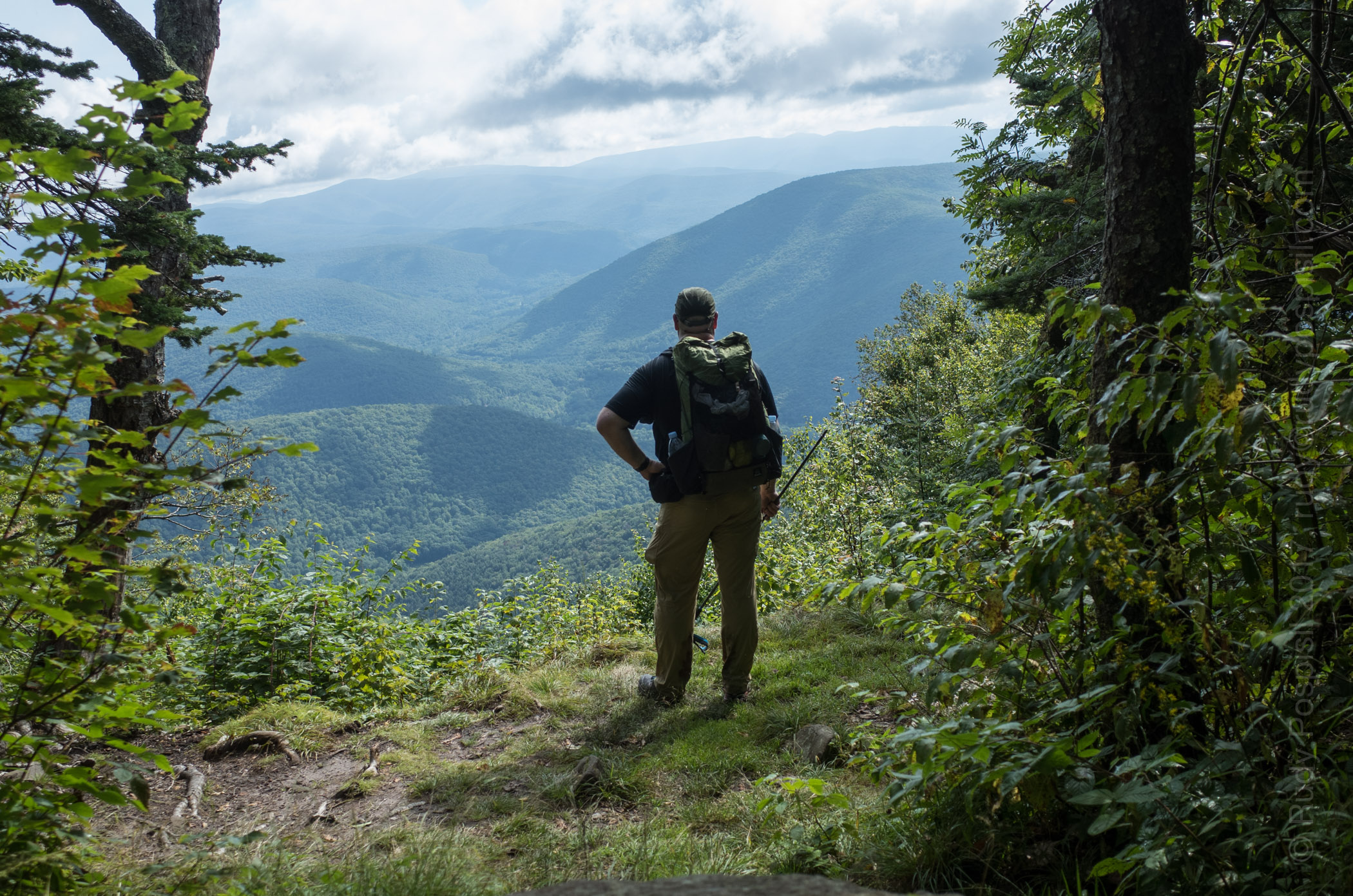
I loved the journey and it was an amazing experience but it left me wanting to explore more on my own two feet. That led me into backpacking and I’ve been spending a lot of time in the Catskill mountains hiking and camping on the various mountains (see my Catskill 3500 posts).
I spend a lot of time reading blogs for tips and experiences and every once in a while, I come across a photo of someone pitching tent in the Scottish highlands. Nothing is as picturesque as seeing a pitched tent with the rolling Scottish hills in the background. Amazingly beautiful.
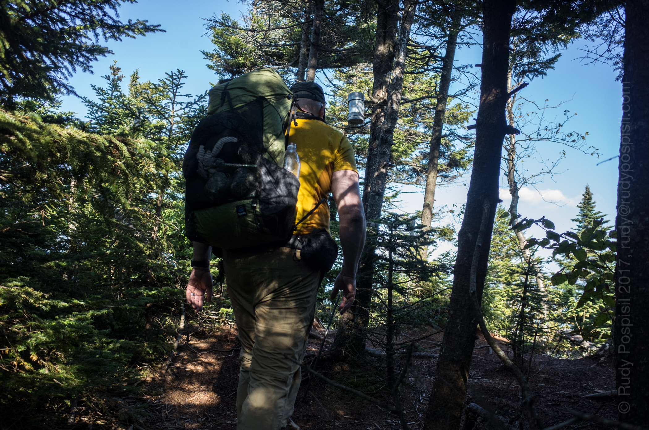
As part of my stateside backpacking ventures into the Catskills, I’ve been on the quest to go lighter and lighter in order to allow me to go further and enjoy my trips better. This quest brought me to Zpacks and I’ve fallen in love with their products. A couple weeks ago, I surfed around other parts of their site, notably the “Adventures” section. Here I read about Joe’s TGO trek in 2010. I was immediately hooked by the thought. Entralled, I tell you.
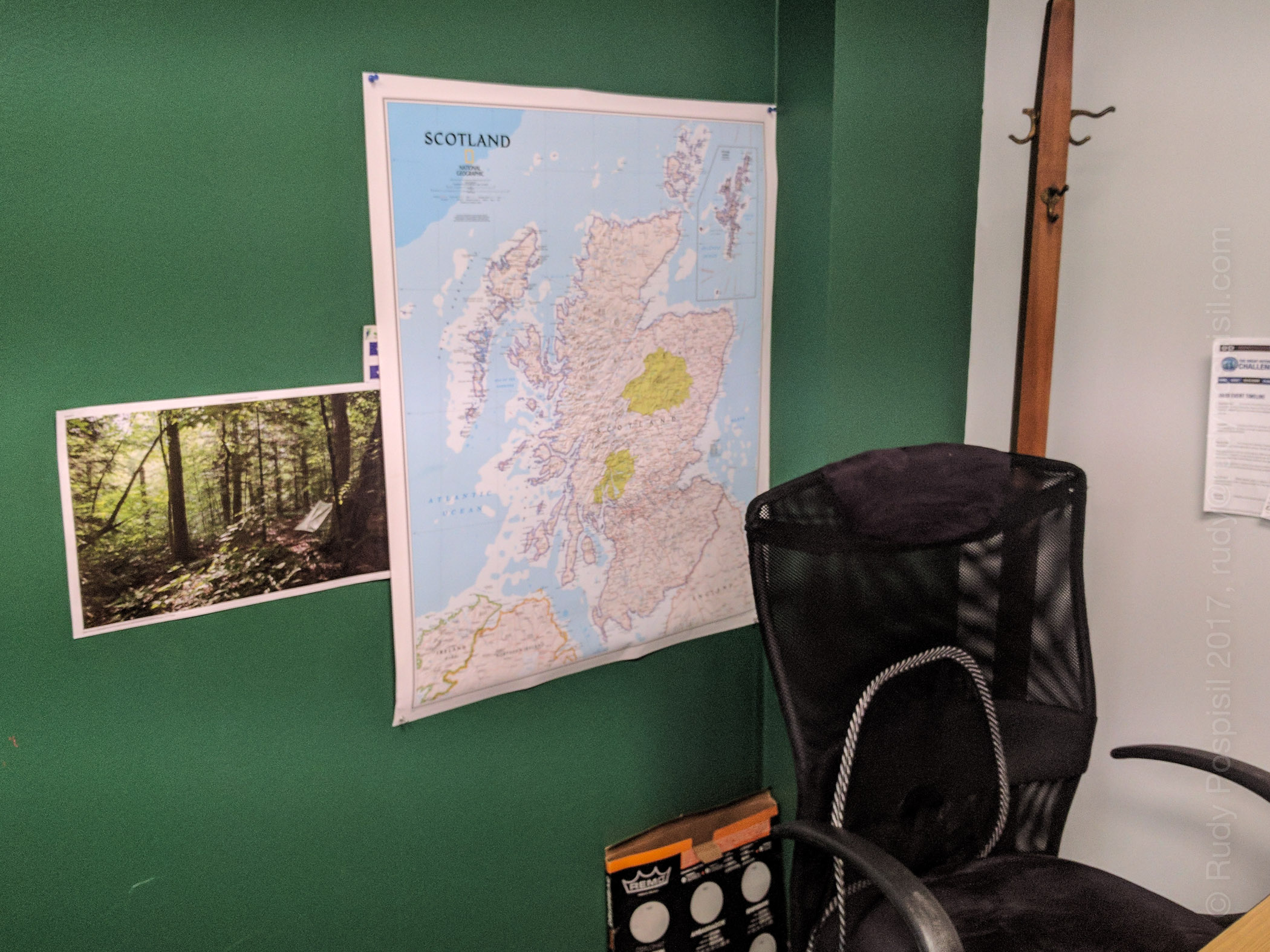
Hanging up a map of Scotland in my office as I begin plans for (hopefully) backpacking across Scotland in the 2018 TGO.
Fast forward… much Googling… reading many blogs of past TGOs… WOW!!! I’m hooked! Backpacking from the west coast to the east coast of one of the most picturesque lands in the world (Scotland, in case you’re not paying attention). Sign me up!
So yeah. This is my planned vacation for next year – the last two weeks in May. Per protocol, I have to submit an application to the The Great Outdoors magazine starting September 15 and I think that I won’t know if I’m accepted until November. Not sure, either all the literature is a bit fuzzy or I’m just not reading it correctly.
This is COMPLETELY up my alley. I’m going for it. Fingers crossed I’m accepted. I’ve hung up a map of Scotland in my office, so now all my co-workers think I’m crazy. Actually, I ride my motorcycle every day, including winter, so they already think I’m crazy. This is nothing new.
In terms of physical preparedness, I backpack most weekends, with the goal of adding summits to my Catskill 3500 list, but I’m stepping up and throwing in 24 mile New York urban hikes. The TGO trek will be, give or take, 200 miles. This equates to a minimum of 15 miles a day for 14 days straight. That’s one thing if it were on level ground in wonderful weather, but it’s going to be in up and down terrain in quite possibly miserable weather. Much more strenuous. Gotta prepare.
Regardless, it’s going to be a lifetime experience, one that I will cherish. Stay tuned. I will post as I prepare.