I finally broke into double digits this weekend, bagging West Kill Mountain, #10 on my Catskill 3500 list.
There was call for a lot of rain this weekend but I managed to have luck on my side. It was pouring in Manhattan early Saturday morning when I woke up. I packed up and then waited. I didn’t want to ride up in the rain and then have to pack away my riding gear wet. Around 9:00am the storm passed, I packed up the bike, and headed north, arriving at the Spruceton DEC parking lot around 12:00 noon. This trip took a bit longer because I had to travel down backroads quite a bit to get to the lot.
I arrived to an empty lot, switched clothes, and saddled up the backpack, which by the way, was a brand new ZPacks Arc Blast. I love my Osprey Exos but I’ve been reading about the Arc Blast (and the cutting edge ultralight products of Joe Valesko) for over a year now and have been wanting to try it out for myself. I was not disappointed and will post a side by side review of the Exos vs Arc Blast when I’ve spent a few more trips with it.
This trip was also the maiden voyage for a Zpacks Duplex tent which blew me away far more than the backpack. I’ve been backpacking with a Hilleberg Unna tent for over a year now but its strength isn’t as a lightweight, hot weather tent. These two new ZPacks additions have taken my base weight down almost five pounds. More to come on these two products in later posts.
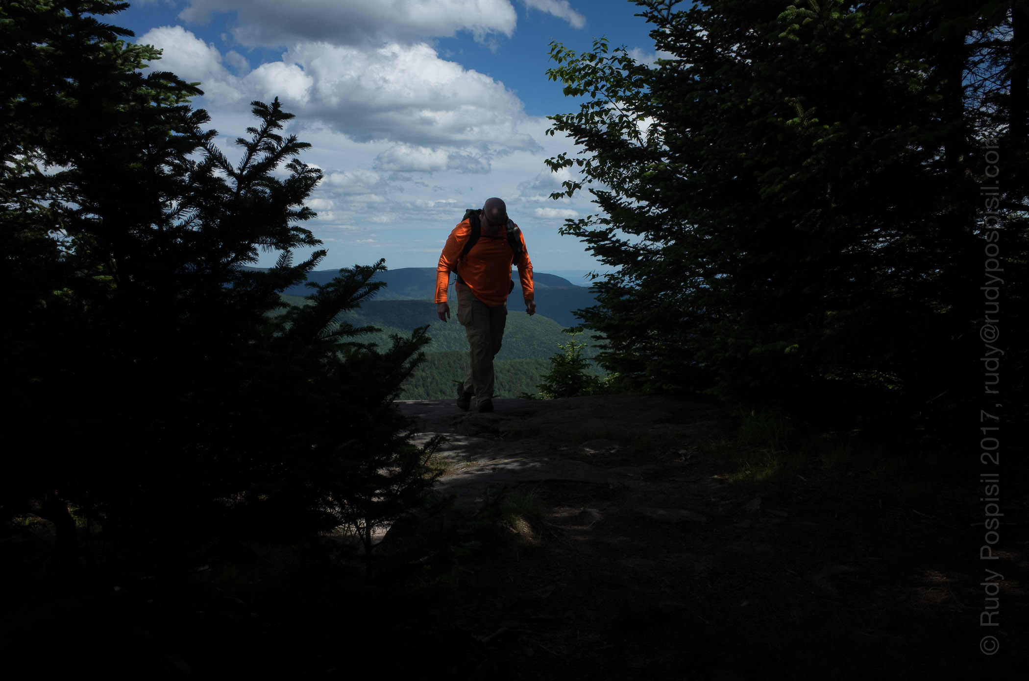
The weather was gorgeous the entire day in West Kill. The hike started off on the fairly flat blue blazed Diamond Notch trail that runs along West Kill (kill being a dutch word that means creek), then veered onto the red blazed Devil’s Path which was a consistent steep climb up until a bit past the 3,500 ft marker, and then eased off for most of the rest of the way to the summit (though there were a few steep portions) with a mandatory rest stop at Buck Ridge Lookout for spectacular vistas.
Heading back down, I found some perfect forest floor at 2,400 ft to pitch tent for the night (however, the bear bagging experience was fraught with inordinate amounts of bad luck). The timing was perfect as it began to rain approximately an hour later and rained all through the night and early morning – a great test for the ZPacks Duplex tent which performed swimmingly (and I don’t mean this literally, I stayed completely dry). The rain finally stopped around 7:00am. I packed up and hiked out dry, back to the bike.
Anyway, enjoy the following photos. See you on #11.
Arriving on my BMW R1200GS at the Spruceton DEC overnight lot for the trip up West Kill Mountain.The West Kill Mountain trailhead. I could not find the register box.Diamond Notch Falls of West Kill being enjoyed by numerous hikers and backpackers.Once past the Diamond Notch Falls and now on the red blazed Devil’s Path, the hike is a steady uphill climb.Hitting the 3,500 ft elevation marker, always a natural high.Once past the 3,500 ft marker the climb decreases in intensity.The “Rock Overhang,” not the most original of names. It reminds me of one of those traps hunters set to catch their dinner, except this one is human sized.Just playing with some eye-level macro photography.Yours truly, completely soaking in the majestic view at Buck Ridge Lookout. BTW, you’ll notice that I’m sporting my new ZPacks Arc Blast.A panorama of the Hunter / West Kill Mountain Range and beyond. Stunning and breathtaking, to say the least. This is from Buck Ridge Lookout, only a short distance from the summit.A panorama of the Hunter / West Kill Mountain Range and beyond. Stunning and breathtaking, to say the least. This is from Buck Ridge Lookout, only a short distance from the summit.The summit of West Kill Mountain. No views here, they’re all at Buck Ridge.Heading back down. It always seems steeper going downhill. Here, I’ve tossed down my poles to free up my hands.Refilling my water bottles at a water source around 3,100 ft. OMG, this water was amazing and incredibly cold. You can see the cold sweat on the plastic bottle I just filled. You’ll never understand drinking Dasani ever again.Setting up camp for the night. I just finished hanging the bear bag. The Zpacks Duplex tent was a breeze to set up, though not pitch perfect on my part this first time. I’m using my Hilleberg Unna groundsheet to avoid packing up a muddy-bottomed tent the next morning.Here’s a nice photo of Sunday morning, after having slept solidly all night throughout the rain storm. The ZPacks Duplex was a palace.The elevation graph from my Garmin Montana GPS showing the ascent of West Kill Mountain. I don’t know what all of those little spikes signify.Google Earth mapping of the trek to the summit and back of West Kill Mountain.On the bike and heading back to Manhattan. A horse enjoying some time in the sun, watching passers-by.West Kill Church with a sign by the cemetery that reads, “So Long”. Not sure they realize what they’ve done. Either that, or they have a macabre sense of humour.Margo’s Hungarian German Restaurant. This must have been the place to go many, many moons ago.
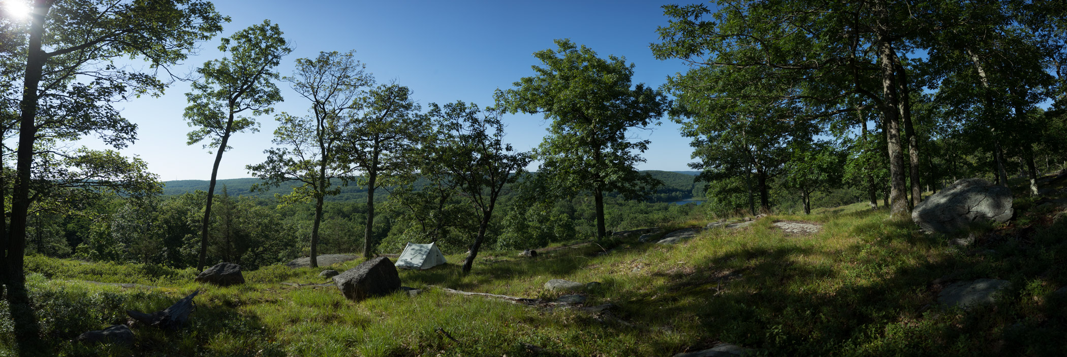
A couple years ago, I “stumbled” upon an amazing overlook in Harriman, perfect for pitching camp and waking up to a great view. It’s provided a great, easy getaway from NYC. Here are a couple photos…
My “secret” spot in Harriman State Park.My “secret” spot in Harriman State Park.
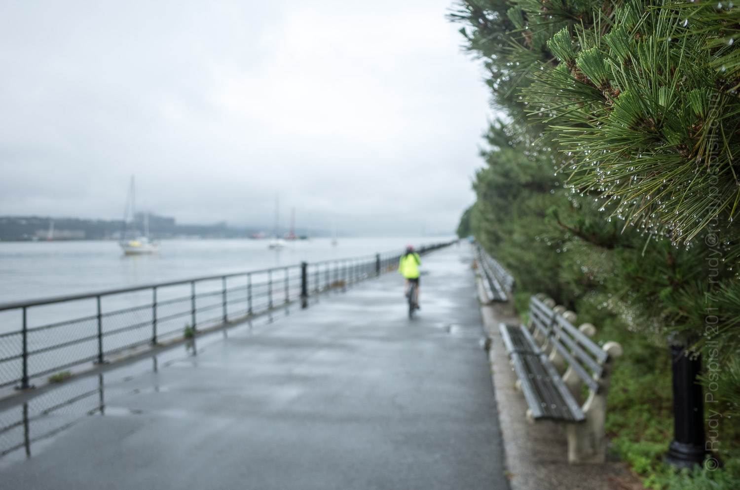
I wanted to go backpacking up in the Catskills this weekend but rain was forecasted quite a bit. I didn’t want to ride up there in the rain, change in the rain, pack up my motorcycle gear wet, and then start backpacking wet knowing that my gear would be wet the entire time. So I compromised. I had to run an errand Saturday morning and figured that I would stay in town and do a pseudo-hike by trekking on the Henry Hudson bike path from 59th street to 200th. As the crow flies, this would probably be a minimum of seven miles. With all the meandering, it was probably close to eight miles albeit with little elevation gain.
I ran my errand and then started the trek home. The rain was coming down hard. Because I was trekking urban, I took my homemade frameless Ray Jardin backpack with an umbrella tucked in the side pocket.
Rainy day hike along the New York side of the Hudson River.Looking down Pier 1 from inside Pier 1 Café on the Henry Hudson Greenway.Urban waterfalls along the Henry Hudson Greenway.Hiking past the New York City Marina along the Hudson River Greenway.Passing by the rain soaked 96th Street clay tennis courts.Finally able to get off the asphalt and pound some dirt.Water, water everywhere but not a drop to drink.Passing under the Henry Hudson Parkway.Soccer field at 144th Street, north of West Harlem Pier and the Fairway grocery store.Passing by a salt depot by the Northern Riverside Park area.Lots of parties happening in the Northern Riverside Park.Fishing in the Northern Riverside Park with the George Washington Bridge in the background.Coming upon a fellow camper along the Henry Hudson River.This confounded me. Rather than simply removing the broken glass, the city leaves it dangerously in place and simply wraps caution tape around it.Underneath the George Washington Bridge, Fort Washington Point.Passing by Inspiration Point near Fort Tryon.New York City hiking, cars whizzing by less than five feet from the path. Fort Tryon is in the background.Back home in Inwood, approximately eight miles later. The hike went from 57th Street to 200th Street.
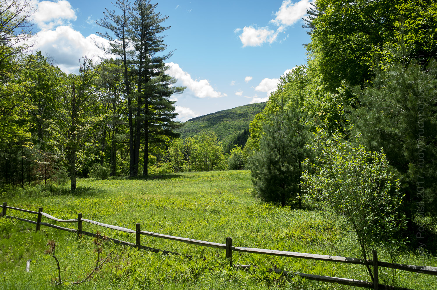
The second mountain this year of my Catskill 3500 journey.
Arriving at the Platte Clove parking lot for the hike up the Catskill’s Indian Head Mountain.Walking from the Platte Clove parking lot to the Indian Head Mountain trailhead. Does this look like a scene from a jigsaw puzzle or what?Starting out on the trailhead. A pretty simple path.After a bit, the path starts getting rocky.After a bit, the path starts getting rocky.A very precarious walk along the edge of a cliff.Coming up on the first vista. Perfect blue skies.Coming up on the first vista. Perfect blue skies.Coming up on the first vista. Perfect blue skies.Coming up on the first vista. Perfect blue skies.Looking down the steep bit of rocks I just climbed.Coming upon another beautiful vista. There is a perfect rock slab to perch upon.Coming upon another beautiful vista. There is a perfect rock slab to perch upon.Coming upon another beautiful vista. There is a perfect rock slab to perch upon.Coming upon another beautiful vista. There is a perfect rock slab to perch upon.Let another beautiful view, this one extremely close to the summit.Let another beautiful view, this one extremely close to the summit.Let another beautiful view, this one extremely close to the summit.Heading back down Indian Head Mountain.Looking for a spot to camp.It’s been a challenge, I’m tired. Setting up the Hilleberg Unna for the night.Garmin Montana GPS elevation graph showing the ascent of Indian Head Mountain.Google Earth map showing the to and fro hike of Indian Head Mountain.Heading back to the Platte Clove parking lot, loving the level ground.Artist in Residence program.Back at the parking lot, the trusty BMW R1200GS had a good night’s sleep.Passing by a Confederate Flag on the way home. What are they doing up in Yankee territory?