Happy Days!!! I received word that I’m in – I made the cut and I’m eligible for the 2018 TGO (The Great Outdoors) Challenge, a coast to coast Scotland backpacking adventure.
Acceptance email for TGO Challenge 2018, backpacking Scotland coast to coast.
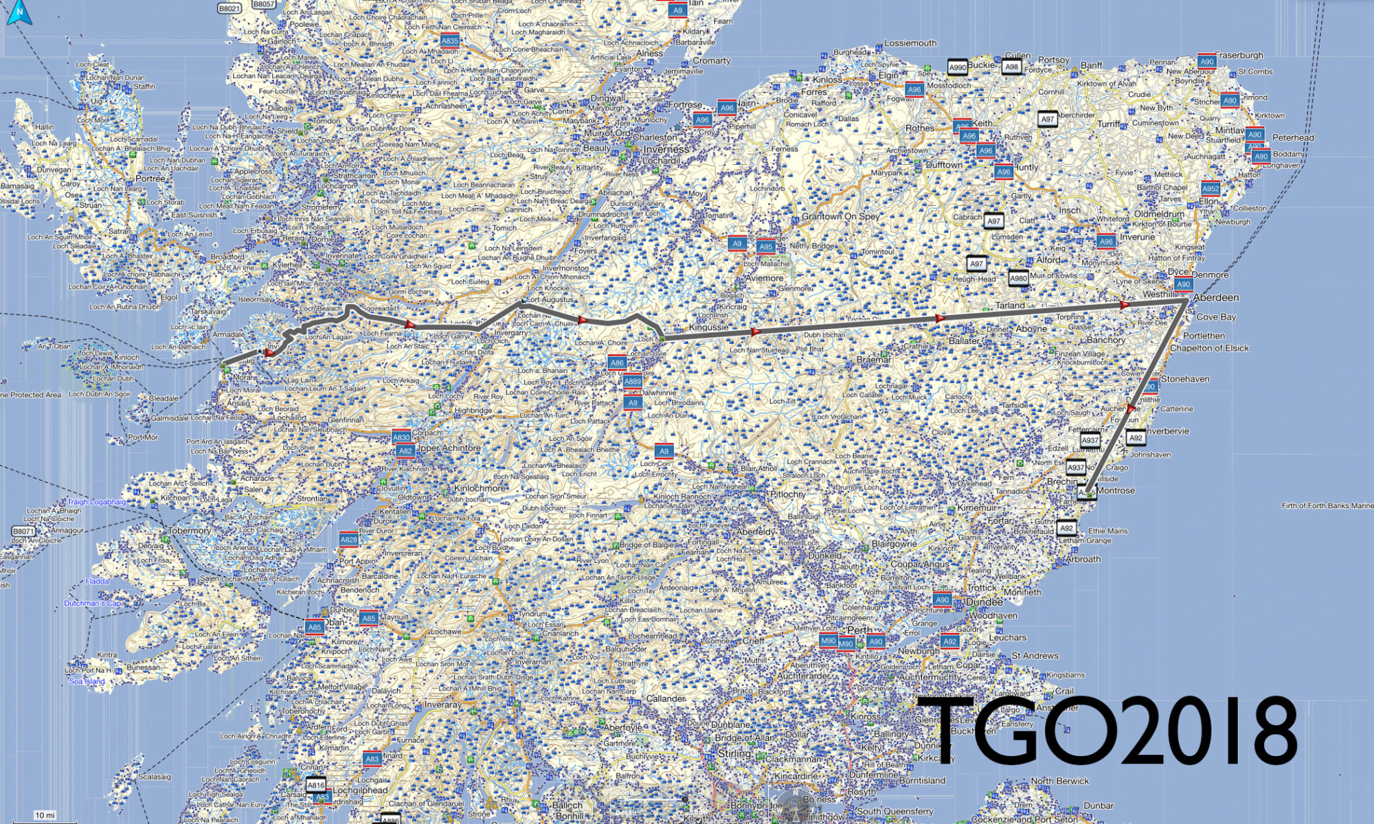
I just sent in my entry fee to make it official and now I have to plan out my route to present to the TGO Challenge vetters. For those who don’t know, the TGO Challenge, in its 39th year, is a self-sustained backpacking trip from the west coast of Scotland to the east coast. Scotland is very unique in that they allow for “wild camping” on most outdoor private and public land and the culture is very accepting of this (unlike here in the States where you’d probably get shot as a trespasser).
So, now I begin the planning. I’m in the infancy stage but my initial thoughts are to:
1. Fly into Glasgow
2. Take a train to Mallaig and sign in
3. Take a ferry to Inverie
4. Backpack several days over to Loch Ness (gotta check out Nessie)
5. Backpack down to Newtonmore, stay in a hostel and have a nice shower
6. Backpack several days over to Aberdeen
7. Take a bus down to Montrose and sign out
Averaging 15 miles a day, this will take me approximately 12+ days to complete. That should allow me an extra day in Aberdeen and an extra day in Montrose if all goes well.
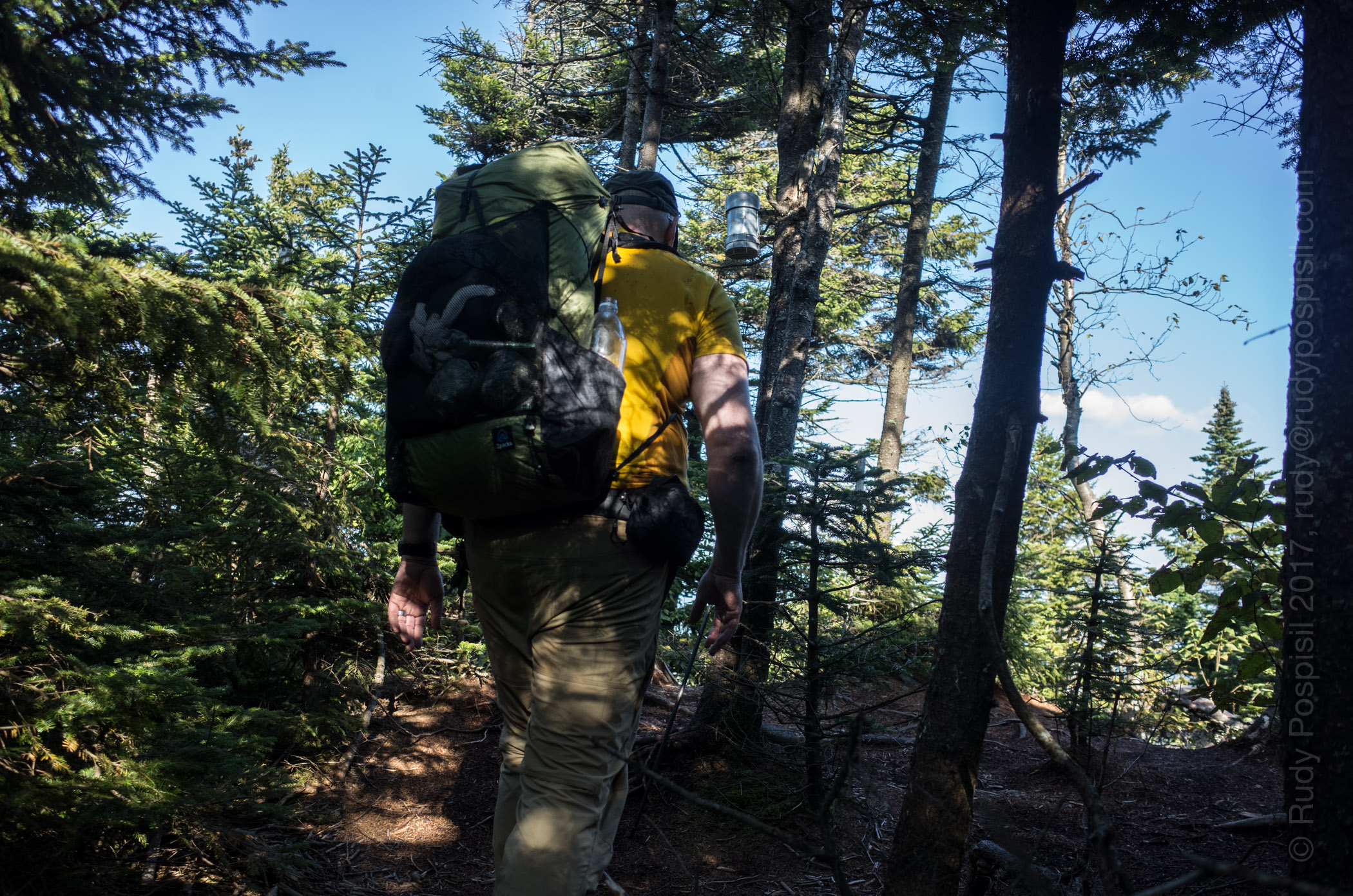
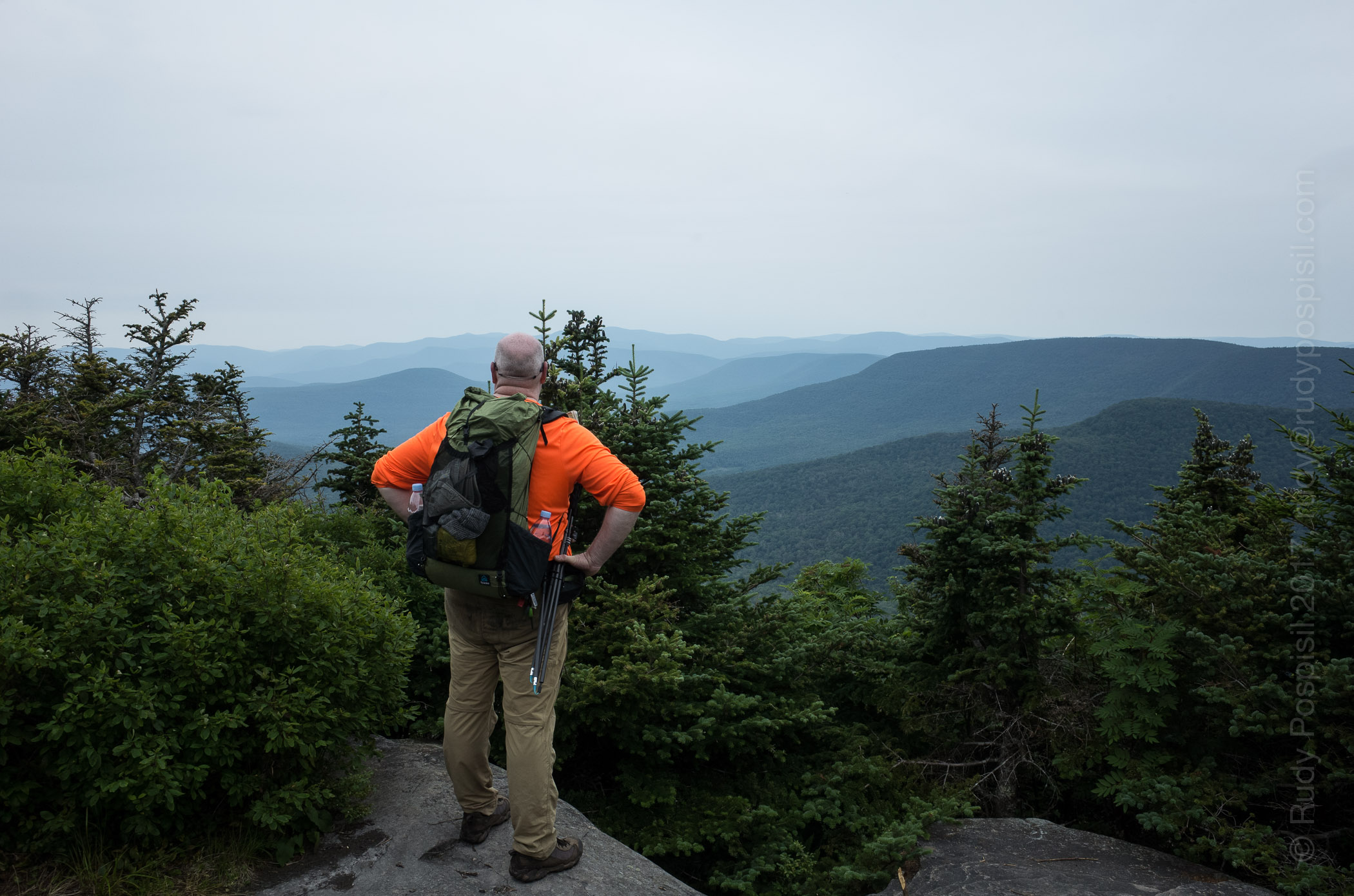
It’s Wednesday morning. I woke up to rain again. It’s a bit annoying for the simple matter that wet gear and wet clothes are no fun. I suppose that simply adds to the challenge and it has been a challenge. Three bushwhack peaks now bagged. Let me take advantage of the rain and use the time to bring you up to date.
I arrived at the DEC Denning parking lot on Saturday, September 2 around 3:00pm – later than originally planned. Speaking of plan, the plan was to backpack in along the Neversink River using the Fisherman’s Path (a herd path), camp, and fill up with water at the base of the col between Friday and Balsam Cap, bag them the following day then camp in the col of Balsam Cap and Rocky, bag Rocky and Lone the following day, camp out and finally on Wednesday, hike back to the bike and head home.
Well, it’s Wednesday morning, it’s pouring outside, and I’m sitting in a tent in between Rocky and Lone, well off plan.
I packed away my motorcycle gear, donned my backpacker persona, and headed in. The hike starts on the Trail, a path nestled within private land. It’s only 1.2 miles and extremely easy (ie, flat). At its end and where the … trailhead begins is a primitive camp. It’s also where the Fisherman’s Path begins, marked by a makeshift cairn. This is what I was looking for. The path would take me to the point where I would begin my climb up to the first of the bushwhack climbs, Friday.
I fumbled around the primitive camp site (there were three) a bit trying to orient myself and locate the path. After five-ten minutes, I happily noticed a cairn marking a well-trodden herd path heading ENE – this must be the place.
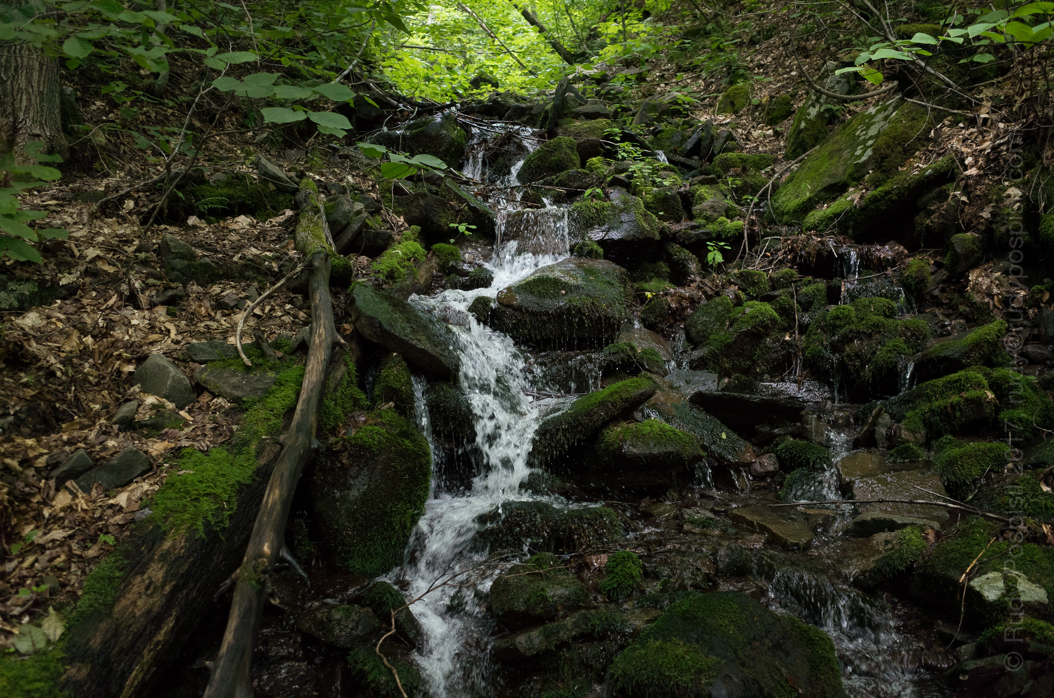
The Fisherman’s Path heads east and follows along the south side of the Neversink River and provides not only beautiful sights but also a constant source of refreshing water – no need to ration.
The path is fairly well worn but easy to lose from time to time as your attention strays. This happened to me when the path crossed the river without me realizing it and I found myself traversing up a steep slope. At this point it was nearing dusk and I needed to set up camp for the night. The steep side of a mountain wasn’t going to work. I came upon a gully and took it back down a hundred feet or so. I found a flat spot but being at the bottom of the slope that I had just climbed down and knowing that rain was in the forecast, this caused concern. I could easily find myself waking to a waterfall streaming into my tent in the middle of the night.
I looked across the Neversink and saw a few potential campsites. In fact all the while I had been hiking, I noticed many times what appeared to be a herd path along the northern shore.
Crossing the river across the myriad of stones available, I alit on the north shore. Within a few minutes I located a nice spot making sure that I was a minimum 50 paces away from the river. I set up the tent, hung the bear bags (one containing six days of food, the other my cookset), and retired. I wasn’t hungry and decided to wait and eat in the morning.
Then the rain started and except for a few momentary respites, didn’t stop for 22 hours, from approximately 7:00pm Saturday till 3:00pm Sunday. Heavy and relentless. I didn’t deem it safe for me to venture out on a bushwhack during a torrential rainstorm, not to mention how miserable I would be, so I opted to wait it out in the tent. It was boring. I slept and read but I was dry. At one point around 10:00am, the rain let up as it had done a few times before (and then promptly started up with gusto). I went to check on the bear bags. I had heard a thud during the night and was worried they had fallen. They were fine. The sky wasn’t clearing up so I expected the rain to return. I reached up to pull them down (hung via the PCT method) to grab some food bars and sure enough the rains started back up.
Not wanting to get in the tent with soaking wet clothes (call me no fun), I stopped and quickly ran back. Just as I zipped the door closed, the rains kicked into overdrive. The day officially became a zero. Not in my plans. When the downpour finally ended at 3:00pm, it was too late to pack up and head out. Sure, I could get in a few hours of travel time before having to set camp but I didn’t know where this would land me. I would be completely off trail in unknown rugged backcountry and felt safer to fresh in the morning. Additionally, the rain would have soaked in allowing for much safer footing. Looking back, I suppose I could have done a Skurka and simply battled it out, but I was on vacation and wanted to have fun and be safe. No worries, though, as you’ll see that I ended up taking this approach at a later date in the trip.
Monday arrives. I ponder whether I’ve ever slept as much in a 24 hour period. Probably only when I’ve been sick.
[to be continued…]
The DEC Denning parking lot where my trusty BMW R1200GS sat for a week, waiting for me to return.Signing in at the Register at the trailhead of the East Phoenicia Branch trail in the Slide Mountain Wilderness of the Catskills.The East Phoenicia Branch trail in the Slide Mountain Wilderness of the Catskills.The cairn marking the trailhead of the Fisherman’s Path.Hiking on the Fisherman’s Path along the Neversink River.Camping near the Fisherman’s Path along the Neversink River.Enjoying the view while having breakfast on Monday morning.Filling up with water to ensure I have enough for the ensuing four mountain bushwhack.Finding my way over to the Catskill Divide between Friday and Balsam Cap Mountains.Finding my way over to the Catskill Divide between Friday and Balsam Cap Mountains.One of numerous obstacles I encountered on my way over to the Catskill Divide between Friday and Balsam Cap Mountains.Making my way to the Catskill Divide between Friday and Balsam Cap Mountains.Taking pack off and resting on the Catskill Divide between Friday and Balsam Cap Mountains.Making my way up to Friday along the Catskill Divide ridge line. I believe that’s Panther in the background.Making my way up to Friday along the Catskill Divide ridge line.A massive rock standing between me and the Friday peak.Hoofing up the southern side of Friday Mountain.Panther and Cornell as seen on the way to the peak of Friday Mountain.Pushing past fallen trees along the Catskill Divide ridge along on the way to Balsam Cap.Another rainy night. Camping out below the Catskill Divide ridgeline in the col between Friday and Balsam Cap.Making my way up to the peak of Balsam Cap.Ashokan Reservoir as seen from the Catskill Divide ridge line on Balsam Cap.Your’s truly bagging the grey canister on Balsam Cap.Steep rocks to climb on the way up Rocky Mountain.Massive uprooting on Rocky Mountain.Caught in a hailstorm near the peak of Rocky Mountain.Yours’ truly bagging the grey canister on the peak of Rocky Mountain.The view on the way to Lone Mountain.Traversing the flat col between Rocky and Lone was offset by the serious amount of “blow down”.Traversing the flat col between Rocky and Lone was offset by the serious amount of “blow down”.The opportunities to skewer myself were great, indeed.A tight squeeze on Lone Mountain.I should have brought my lawn mower. I’ve never lush grass like this before on a Catskill mountain.Yet more dense blow down to push through. It was relentless.Yours’ truly bagging the grey canister on the peak of Lone Mountain.Heading back down from Lone Mountain to Neversink River.Finally. Water to replenish my supply. It’s a bit brown from the previous several days of hard rain.Camping out along the southern side of the Neversink River as I make my way back home.The heavy rains made it very difficult to keep track of the Fisherman’s Path herd path.Crossing the foot bridge along the Peekamoose-Table blue-blazed trail.Arriving back at the DEC Denning parking lot and the BMW R1200GS, six days later.Garmin GPS elevation graph of my roundtrip Friday-Balsam Cap-Rocky-Lone bushwhack.Google Earth map of my roundtrip Friday-Balsam Cap-Rocky-Lone bushwhack.Topo map showing my roundtrip Friday-Balsam Cap-Rocky-Lone bushwhack.NY/NJ Trail Conference map showing the “Bushwhack Range”.
Work’s been a bit grueling. My boss offered me Friday off which I gladly accepted and turned it into a three day Catskill weekend. The plan was to ride up on Friday morning, climb up Eagle Mountain and camp out on Haynes Mountain. Saturday, I would bag Balsam and then trek back over Haynes and Eagle and camp out near the Shandaken shelter. This would give me #14 and #15 on my Catskill 3500 list. Sunday would be a nice leisurely trek back to the bike and (sniff) back to Manhattan.
The forecast called for lots of rain over the weekend. It was raining pretty hard first thing Friday morning, so I waited it out until it stopped around 9:30am. This was good timing as it got me on the road after rush hour. Anyone who’s taken 17 during rush hour knows what a horrible experience that can be.
I arrived at the empty Seager Road DEC overnight parking lot around noon. It barely sprinkled during my ride up. I was worried that I’d have to pack up my motorcycle gear wet – fortunately this wasn’t the case.
Parking at the Seager DEC overnight lot and trailhead for the Seager-Big Indian trail.
I mapped out taking the yellow-blazed Seager-Big Indian Trail (SBI) to the blue-blazed Pine Hill West Branch Trail (PHWB). The first two miles of the SBI trail are actually through private land. The owner has been gracious enough to allow hikers to pass through on the sanctioned trail but anything outside the trail is private and not to be trespassed on, nor is any camping allowed. The path crosses the Shandaken Brook a few times, so there is plenty of opportunity to fill up with cool stream water. Make sure to follow the yellow blazes and make sure to keep an eye on them. There are a lot of trails branching off but these are private jeep paths.
Backpacking through the private land portion of the Seager Big Indian trail. The Shandaken Brook runs the length of it, so plenty of water to drink.
Once past the two mile mark, the land becomes public and is marked as such. Shortly past this is the Shandaken Shelter, poised right on the bank of the Shandaken Brook. I was actually quite surprised that the DEC has a shelter directly on the water. Anyway, be warned that this was the last water source until I returned.
Entering the official public DEC-managed land.The Shandaken shelter, right on the Shandaken Brook, two miles out from the Seager parking lot.
From the shelter, it was a mile before hitting the junction for the blue-blazed PHWB trail. It started drizzling but nothing that warranted wearing any rain gear. I took a louie and headed north up Eagle Mountain, and the rains came. It began coming down hard. I recently purchased a Snow Peak ultralight hiking umbrella and this provided a perfect opportunity to give it a go. I don’t like hiking in rain gear because it never breathes well and it just makes me sweat, so I thought that the open air ventilation of an umbrella might do the trick. It did, however I immediately realized that using the trekking poles was no longer viable. Maybe an umbrella hat, ha ha.
The rains came. I pulled out a Snow Peak ultralight umbrella and kept dry for the most part. It was much easier than stopping, taking off the pack, and putting on rain gear, not to mention that I would then start getting clammy.
Reaching the summit of Eagle Mountain was a bit steep at times but nothing outrageous. As you near the peak, there is a short herd path that heads west of the SBI trail and takes you to a large cairn, an obvious marking of the peak.
The 3,500 ft elevation marker on the south side of Eagle Mountain.The cairn marking the peak of Eagle Mountain in the Catskills.
Ahh, #14. Unfortunately, there was no view whatsoever. I was planning on using the occasion to boil some water and cook up some dehydrated Chana Masala. In bear country, it’s always best to cook any food far before you reach campsite. However, I pulled a Reese Witherspoon/”Wild” – I forgot my flint (she bought the wrong fuel). So, I ate a meal bar, took my photographs of the cairn, and continued the trek north towards Balsam. This would take me over Haynes Mountain which, at 3420 feet, is too short to be a Catskill 3500er. As such, however, it’s legal to camp at the peak which was my plan.
Heading up and over Haynes Mountain on the way to Balsam Mountain.
Reaching the top of Haynes, I realized that there weren’t any good camping options. The peak was lush with vegetation, along with being riddled with rocks and fallen trees. I scurried down the north side of Haynes and soon found a very favorable bare, level spot surrounded by trees and ground covering. It was quite serene and exactly the kind of spot I love to set up in. Nature at its lushest. The rain had stopped a while ago and I was able to pitch in the dry. I had about a liter of water left but no worries as my plan was to fill up at the designated water source marked on the NY-NJ Trails map. I hung the bear bag, laid out my wet clothes, and was sawing logs by 7:00pm.
Waking up Saturday morning in my trusty Zpacks Duplex tent on the north side Haynes Mountain.
I got in a good 12 hours of slept, my body was happy. I woke up 7:00am, packed up, and headed northeast to Balsam, approximately 1.5 miles away. Nothing eventful, just a steady, rocky incline to the top. Again, no view, just a makeshift cairn. The NY-NJ Trails map showed a “starred scenic view” a bit north of the peak, so I decided to take a look. Wow! I was taken aback by the view, it was truly mesmerizing. I sat there for an hour and soaked in the view and the sunshine. I also took the opportunity to take off my shoes and socks and see if I could get them to dry out a bit.
The cairn marking the peak of Balsam Mountain.Yours truly, breath taken away, overlooking the Slide Mountain and the Hunter-West Kill Mountain Wilderness from the top of Balsam Mountain in the Catskill Mountain Range in upstate New York.Panorama overlooking the Slide Mountain Wilderness and the Hunter-West Kill Mountain Wilderness areas from the top of Balsam Mountain in the Catskill Mountain Range in upstate New York.Drying out the trail runners. The Oboz have been giving me hot spots. After a lot of research, I’m trying a pair of Hoka Oné Oné Speed Goat 2 trail runners.
Balsam is one of the required winter peaks, so I’m going to remember this spot and plan on setting up camp on the perch. What an amazing view to wake up to in the white of winter.
The hour passed and I strapped everything back on to begin the trek back to the Shandaken shelter. Down Balsam, up Haynes, down Haynes, up Eagle, down Eagle.
Coming down Balsam, I stopped at the designated water source to fill up but… it was nowhere to be found. There wasn’t even any evidence of one in the past. I had half a liter left. This would need to be rationed over the next 4.5 miles and it was quite humid. I’ll be fine.
As I passed this uprooted tree, I was blasted by hot air which I assumed was energy dissipating from open roots. A very strange feeling.
As I was huffing and puffing back up Eagle, having traversed Haynes, some guy in his 50s comes flying past me. “Come on, this is an easy one.” I hate people like this. I reached the herd path to the peak and figured I’d go in for a second look. The same guy is there, typing into his cell phone. He has absolutely no sweat going on and I’m standing there drenched. Did I mention that I hate these people?
Turning around, I headed down the south side of Eagle Mountain for the last 2.1 miles to the shelter. I arrived around 3:00pm with 2-3 ounces of water left and filled up with glorious Shandaken Brook water. Finding a spot far enough from the shelter and privy, I set up for the night, and eventually dozed off while reading my Kindle. Later in the night proved to be quite eventful. I was awakened by bright LED flashlights scouring the area. There were quite a few people at the shelter and I assumed that one of them must have lost something and a few of them were looking for it. Either that or they were drunk and looking for the loo. The lights eventually subsided and I fell back to sleep, only to be awaken a couple hours later by another bright flashlight, this time someone night hiking through the trail (not a good idea). Oh, and during this time, it rained quite heavily throughout the night. I had pitched my tent underneath some overhanging foliage, so I was spared the brunt of it.
Morning came, I arose, packed out, and hit the trail by 6:30am. It was a nice easy two mile trek back to bike, albeit quite sloggy from the rain the night before. Pack up the bike and back to Manhattan with a recharged soul. Nothing is more invigorating than being off the grid and breathing in pure mountain air for a straight 48 hours. See you on #16.
The trek back to the parking lot was quite muddy and wet due to the rainfall throughout the night.The register box and the BMW R1200GS in the distance. Time to go back to the rat race.Elevation graph showing the ascents of Eagle, Haynes, and Balsam Mountain (with the scenic overlook at the end).Google Earth map showing the roundtrip backpacking trip from Seager to Eagle Mountain to Haynes Mountain to Balsam Mountain and back.
Last year during the month of May, I rode my trusty BMW R1200GS 5,000 miles/ 8,046 kilometers through Canada over the course of 17 days and camped out along the way (Labrador was the best, though I did love Québec).
I loved the journey and it was an amazing experience but it left me wanting to explore more on my own two feet. That led me into backpacking and I’ve been spending a lot of time in the Catskill mountains hiking and camping on the various mountains (see my Catskill 3500 posts).
I spend a lot of time reading blogs for tips and experiences and every once in a while, I come across a photo of someone pitching tent in the Scottish highlands. Nothing is as picturesque as seeing a pitched tent with the rolling Scottish hills in the background. Amazingly beautiful.
As part of my stateside backpacking ventures into the Catskills, I’ve been on the quest to go lighter and lighter in order to allow me to go further and enjoy my trips better. This quest brought me to Zpacks and I’ve fallen in love with their products. A couple weeks ago, I surfed around other parts of their site, notably the “Adventures” section. Here I read about Joe’s TGO trek in 2010. I was immediately hooked by the thought. Entralled, I tell you.
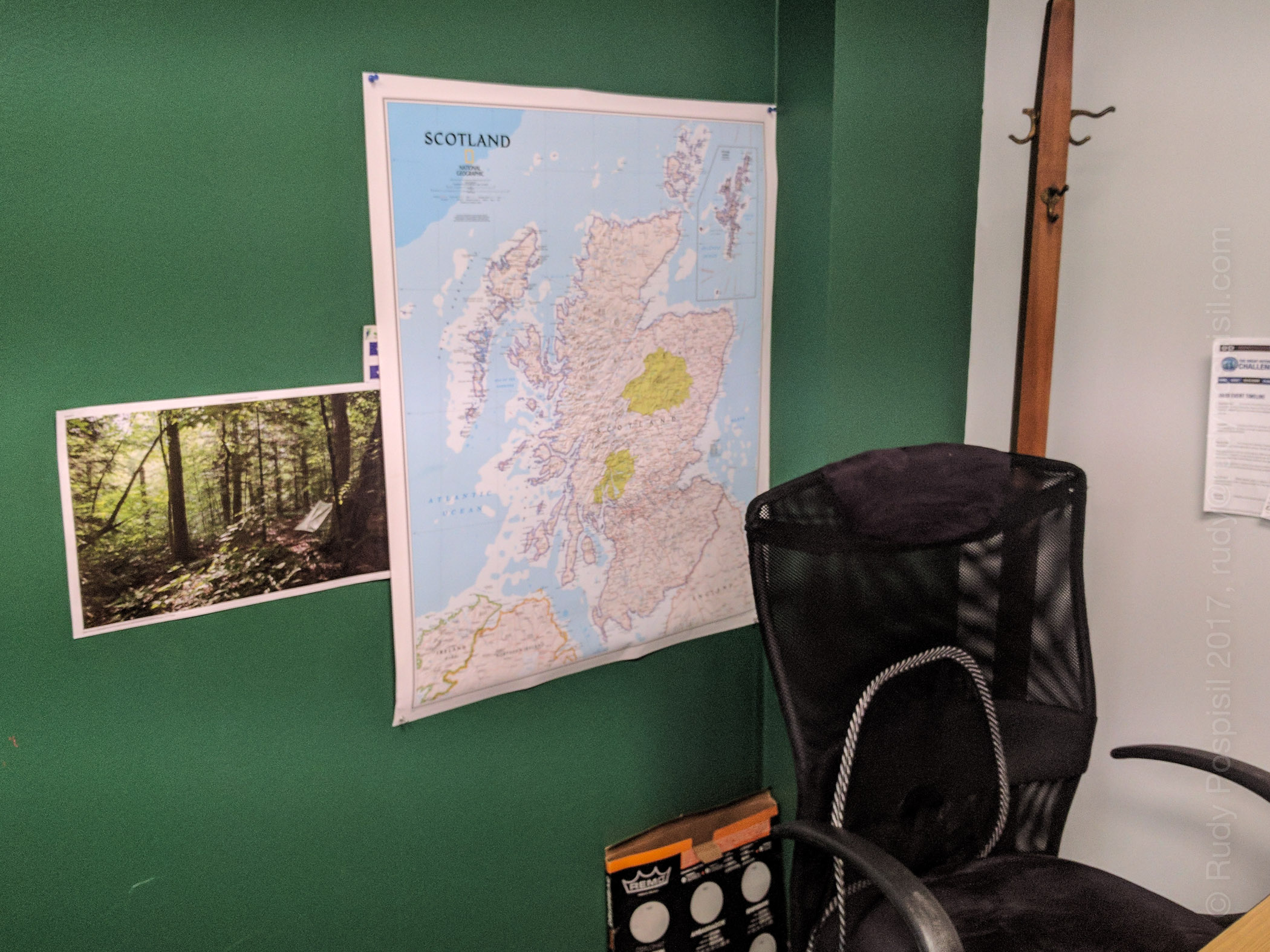
Hanging up a map of Scotland in my office as I begin plans for (hopefully) backpacking across Scotland in the 2018 TGO.
Fast forward… much Googling… reading many blogs of past TGOs… WOW!!! I’m hooked! Backpacking from the west coast to the east coast of one of the most picturesque lands in the world (Scotland, in case you’re not paying attention). Sign me up!
So yeah. This is my planned vacation for next year – the last two weeks in May. Per protocol, I have to submit an application to the The Great Outdoors magazine starting September 15 and I think that I won’t know if I’m accepted until November. Not sure, either all the literature is a bit fuzzy or I’m just not reading it correctly.
This is COMPLETELY up my alley. I’m going for it. Fingers crossed I’m accepted. I’ve hung up a map of Scotland in my office, so now all my co-workers think I’m crazy. Actually, I ride my motorcycle every day, including winter, so they already think I’m crazy. This is nothing new.
In terms of physical preparedness, I backpack most weekends, with the goal of adding summits to my Catskill 3500 list, but I’m stepping up and throwing in 24 mile New York urban hikes. The TGO trek will be, give or take, 200 miles. This equates to a minimum of 15 miles a day for 14 days straight. That’s one thing if it were on level ground in wonderful weather, but it’s going to be in up and down terrain in quite possibly miserable weather. Much more strenuous. Gotta prepare.
Regardless, it’s going to be a lifetime experience, one that I will cherish. Stay tuned. I will post as I prepare.
Okay. I’m on number 13, lucky 13. I (overly optimistically) thought that I could tackle Twin back in June when I climbed Indian Head but that was dumb. When I got to the trailhead of Twin after descending Indian Head, my legs were butter. Maybe next time.
Okay. It’s next time. This weekend I added Twin to my list. I left Manhattan later than planned and arrived at the Prediger Road DEC parking lot around 1:00PM, much later than I wanted. I had pulled into Tannersville to gas up and realized that I had a flat tire. I located some Fix-a-Flat and that seemed to solve the problem though I knew that I would need to replace the tire as soon as I returned home.
Twin Mountain in the Catskills as seen from the road. Twin is the two summits on the right. Indian Head is on the left (notice how it looks like a face?).Riding the dirt road to the DEC Prediger Road parking lot.The Jimmy Dolan Notch Trail trailhead to take you to Indian Head and Twin mountains.
The initial hike on the blue blazed Jimmy Dolan Notch trail was nice and calm, ie flat. After a mile or so, that changed and the ascent became quite challenging. The funny thing, I descended this way last weekend from Indian Head and it didn’t seem so vertical. Did I mention that it was yet another humid weekend up in the Catskills? Not as bad as the previous few weekends but still extremely sweaty. Bugs, however, were much less abundant this go-around though I did get a few Zika bites.
Starting out on the Jimmy Dolan Notch trail from the DEC Prediger Road parking lot.I’ve never seen a mushroom as bright and cheery as this.The trek became steep after the initial calmness on the Jimmy Dolan Notch trail.More steepness (and rocks) on the Jimmy Dolan Notch trail.
Topping out gave way to a small clearing and gave a bit of a reprieve in terms of climbing. The Devil’s Path intersected here. Though the Jimmy Dolan Notch trail technically ended, you could continue north off trail for a 100 feet or so and get a nice view from the actual Notch.
The actual Jimmy Dolan Notch. The view is a bit hindered.
I went right on the red blazed Devil’s Path to ascend Twin (going left would take you to Indian Head). The climb became immediately quite steep again. It was grueling all the way to the first of Twin’s two summits. This first one is the lower one, so don’t get fooled into thinking that you’ve peaked. It’s easy to think this because the view is spectacular, right up there with Giant Ledge.
It’s a steep climb – approaching the lower summit of Twin Mountain from the east side.It’s a steep climb – approaching the lower summit of Twin Mountain from the east side.Hitting the 3,500 foot mark as I’m approaching the lower summit of Twin Mountain from the east side.Yours Truly, looking out over the Catskills from the lower summit of Twin Mountain.A gorgeous view from the lower summit of Twin Mountain.
Heading over to the second, and official, summit consisted of a bit of a drop and then back up but it was short and not too difficult. Again, spectacular views. At this point, I took off my pack, sat down, rested my feet, and soaked in the scenery for a good 1/2 hour. Beautiful!
The view from the top of Twin Mountain.The view from the top of Twin Mountain.I sat down to soak in the view from the top of Twin Mountain. Taking off my shoes, I noticed a cigarette butt. I was stunned that someone would do this. I went ahead and packed it out with my empty energy bar wrappers.
Heading back down, I made a rookie mistake and headed on to Sugarloaf. It took me approximately 20 minutes for me to realize my mistake. I was having to descend down some serious verticals and trying to remember if they had been so difficult going up. I pulled out my compass (which I should have done much sooner) and saw that I was heading west when I should be going east. Oops. I had to turn around and climb up all of the rock cliffs that I had just climbed down. To add to the misery, it started sprinkling and now I’d have slippery rocks to contend with but luckily it never rained past a slight sprinkling.
I don’t remember having climbed up this.I don’t remember passing this. I then realized that I was heading to Sugarloaf. Time to turn back.Here’s where I made my mistake when leaving the summit of Twin. The trail on the left goes back to Jimmy Dolan Notch. The trail on the right goes to Sugarloaf. It’s easy to think that it’s simply one trail wrapping around the trees.
Now that I was heading in the correct direction, I hoofed it all the way back down to the level portion of the Jimmy Dolan Notch trail and set up camp for the night. I pitched the tent, hung the bear bag, and promptly fell soundly asleep. I woke up once around 2:00AM and it was eerily quiet, so much so that I could hear a dead twig hitting the forest floor several hundred feet away.
Setting up the Zpacks Duplex on a nice soft forest floor. The bear bag is off to the left, out of frame.
The next morning, I packed up and hiked the remaining mile or so back to the DEC parking lot. The front tire of the motorcycle was holding up nicely thanks to the Fix-a-Flat. Unfortunately, riding out on the dirt road stressed the tire and it began to go flat again. I didn’t have my plug kit and nothing was open on Sunday mornings, so I made the calculated risk to ride home, checking the tire every so often. I went slow and made it home. The rim looks good. The bike is going into the shop for a new set of tires and a rim inspection. I’ll let you know how that goes.
Filling up with some wonderful, cold spring water. I’ve stopped carrying my Sawyer filter. I find that the BeFree is so much more convenient.Passing a cairn as I’m approaching the DEC parking lot on Prediger Road.The elevation graph from my Garmin GPS showing my ascent of Twin Mountain from the east.The Google Earth map showing my ascent and descent of Twin Mountain from the east.Home, with a flat tire.
This past weekend I decided to knock off two bushwhacks from my Catskill 3500 list. The plan was to backpack up to the summit of Big Indian, cross over east to Fir, and then back down.
I was excited to get away from the humidity of NYC but unfortunately, it was incredibly humid up in the Catskills. I never felt it cool down the whole ride up. Not a good sign.
Upon arriving at the Biscuit Brook DEC parking lot, I de-suited, switched into my hiking clothes, saddled up the backpack, and headed up the road to the Pine Hill West Branch trailhead. Yep, it was super humid. Within 15 minutes, I was drenched in sweat and it was like this the entire trip. Lots of black flies, gnats, and mosquitos also.
Rain was in the forecast, so I wrapped up the backpack in a waterproof trash bag.Arriving at the DEC Biscuit Brook parking lot. There’s a convenient porta-potty for last minute necessities.It’s a short jaunt up the ride to the blue blazed Pine Hill West Branch trailhead.The Register Box at the blue blazed Pine Hill West Branch trailhead.The first two miles of the Pine Hill West Branch trail is a fairly gentle uphill climb.The day was incredibly humid, you can see the moisture hanging in the air.One of many stream crossings on the Pine Hill West Branch trail.There were a few steep sections along the Pine Hill West Branch trail.Water was extremely plentiful for the initial 4.5 miles of the Pine Hill West Branch trail.The 3500 foot elevation marker on the Pine Hill West Branch trail.
My first destination was the summit of Big Indian Mountain. Technically, it is a bushwhack but coming from Biscuit Brook, 99% of the approach is along the blue blazed trail. A herd path branches off about 4.5 miles past the trailhead and goes off for, at most, 1/4 mile before reaching the summit. I can’t imagine an easier bushwhack.
A herd path suddenly appears that’ll take one to the summit of Big Indian Mountain.The herd path to the summit of Big Indian is very well defined and very short, only about 1/4 mile.Success! Signing in at the Big Indian Mountain gray bushwhack canister.
From there, I continued my journey east towards Fir Mountain. Now began the true bushwhack. The herd path quickly disappeared and I had to rely on my compass to ensure that I was moving in the correct direction. The plan was to make it to the low point where Big Indian and Fir met, and set up camp for the night. Unfortunately, thunder quickly rolled in as I started down Big Indian. A major thunderstorm appeared to be looming. I didn’t want to get caught in it and since I was planning on setting camp soon, I decided to stop and drop. I was on some level ground and wasn’t sure that I’d have better options until the valley which would require me backpacking through the storm.
A herd path going off in the direction of Fir Mountain.
Space was very tight and the stakes wouldn’t bite due to the ground being all leaves, but I got the ZPacks Duplex pitched. I hung the bear bag and my sweat drenched clothes and retired for the night just as the rain picked up.
Setting up camp for the night with the ZPacks Duplex.Hanging the bear bag to keep all food out of the tent for the night.A closeup of my homemade waterproof cuben fiber bear bag. No, this is not how I hung it for the night.
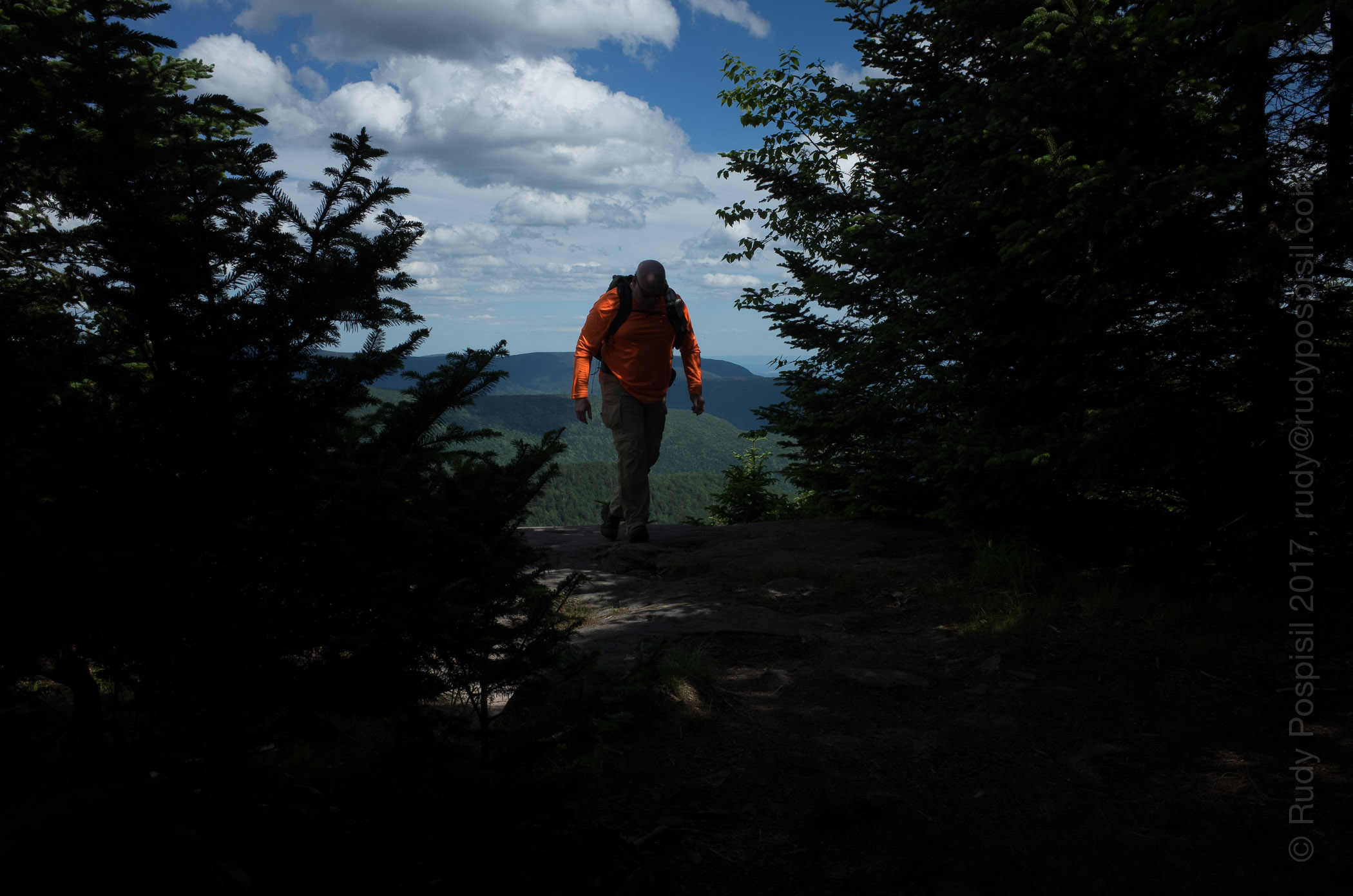
Bright and early the next morning, I packed up and headed over to Fir Mountain. Using my compass, I tried to still upon the Catskill Divide ridge as best as possible as it links the two summits. This was a true bushwhack. Every great once in a while, I would come upon a herd path but it never lasted long. The majority of the trip involved pushing through deep brush, thick tree layers, and jockeying over rock ledges. At one point, I fell down into a gully trying to jump across a ravine and had to administer some minor first aid.
Sunday morning. Time to pack up and head east to Fir Mountain.Bushwhacking through some tough terrain on the way to the summit of Fir Mountain.Every great once in a while, a herd path would appear. These were very short and very infrequent.Bushwhacking through some dense foliage.Bushwhacking through some dense foliage.
It was slow going but I made it to the Fir Mountain gray canister around 12:30pm. It was tricky to find but you have to just keep going up. One thing to note is that there were no water sources. The day before was abundant but not today.
Bushwhack success!!! Signing in at the gray canister at the summit of Fir Mountain.
After a short rest and requisite photography, I began the descent back to the parking lot. The plan was to go south west until intersecting the Pine Hill West Branch trail near the shelter and then take the blazed trail back to the bike. I followed the herd path leading from the summit for perhaps a half hour but then it disappeared. I was now back to bushwhacking and a noticeable decline in pace.
Encountering a deer as I’m heading south down Fir Mountain.Coming upon Biscuit Brook. This was a bit of a precarious crossing.
The descent was steep and long. After a few hours, I came upon a brook and filled up with fresh water. I moved further down and waded across Biscuit Brook and on to the Pine Hill trail. From there, it was two miles back to the bike.
A Biscuit Brook waterfall.Intersecting with the Pine Hill West Branch trail after bushwhacking down Fir Mountain.Heading back on the Pine Hill West Branch trail to the Biscuit Brook DEC parking lot.
Sunday was a tough day. It took me approximately 11 hours to bushwhack from Big Indian to Fir to the parking lot. Very slow going but exhilarating, nonetheless. I switched out of my drenched clothes and into my bike gear, and headed home excited about the shower soon to be had.
The Register Box is a beautiful sight at the end of two long days of backpacking and bushwhacking.The elevation graph of my trek up and down Big Indian and Fir Mountains in the Catskills.My trek up and down Big Indian and Fir Mountains in the Catskills according to Google Earth.
I finally broke into double digits this weekend, bagging West Kill Mountain, #10 on my Catskill 3500 list.
There was call for a lot of rain this weekend but I managed to have luck on my side. It was pouring in Manhattan early Saturday morning when I woke up. I packed up and then waited. I didn’t want to ride up in the rain and then have to pack away my riding gear wet. Around 9:00am the storm passed, I packed up the bike, and headed north, arriving at the Spruceton DEC parking lot around 12:00 noon. This trip took a bit longer because I had to travel down backroads quite a bit to get to the lot.
I arrived to an empty lot, switched clothes, and saddled up the backpack, which by the way, was a brand new ZPacks Arc Blast. I love my Osprey Exos but I’ve been reading about the Arc Blast (and the cutting edge ultralight products of Joe Valesko) for over a year now and have been wanting to try it out for myself. I was not disappointed and will post a side by side review of the Exos vs Arc Blast when I’ve spent a few more trips with it.
This trip was also the maiden voyage for a Zpacks Duplex tent which blew me away far more than the backpack. I’ve been backpacking with a Hilleberg Unna tent for over a year now but its strength isn’t as a lightweight, hot weather tent. These two new ZPacks additions have taken my base weight down almost five pounds. More to come on these two products in later posts.
The weather was gorgeous the entire day in West Kill. The hike started off on the fairly flat blue blazed Diamond Notch trail that runs along West Kill (kill being a dutch word that means creek), then veered onto the red blazed Devil’s Path which was a consistent steep climb up until a bit past the 3,500 ft marker, and then eased off for most of the rest of the way to the summit (though there were a few steep portions) with a mandatory rest stop at Buck Ridge Lookout for spectacular vistas.
Heading back down, I found some perfect forest floor at 2,400 ft to pitch tent for the night (however, the bear bagging experience was fraught with inordinate amounts of bad luck). The timing was perfect as it began to rain approximately an hour later and rained all through the night and early morning – a great test for the ZPacks Duplex tent which performed swimmingly (and I don’t mean this literally, I stayed completely dry). The rain finally stopped around 7:00am. I packed up and hiked out dry, back to the bike.
Anyway, enjoy the following photos. See you on #11.
Arriving on my BMW R1200GS at the Spruceton DEC overnight lot for the trip up West Kill Mountain.The West Kill Mountain trailhead. I could not find the register box.Diamond Notch Falls of West Kill being enjoyed by numerous hikers and backpackers.Once past the Diamond Notch Falls and now on the red blazed Devil’s Path, the hike is a steady uphill climb.Hitting the 3,500 ft elevation marker, always a natural high.Once past the 3,500 ft marker the climb decreases in intensity.The “Rock Overhang,” not the most original of names. It reminds me of one of those traps hunters set to catch their dinner, except this one is human sized.Just playing with some eye-level macro photography.Yours truly, completely soaking in the majestic view at Buck Ridge Lookout. BTW, you’ll notice that I’m sporting my new ZPacks Arc Blast.A panorama of the Hunter / West Kill Mountain Range and beyond. Stunning and breathtaking, to say the least. This is from Buck Ridge Lookout, only a short distance from the summit.A panorama of the Hunter / West Kill Mountain Range and beyond. Stunning and breathtaking, to say the least. This is from Buck Ridge Lookout, only a short distance from the summit.The summit of West Kill Mountain. No views here, they’re all at Buck Ridge.Heading back down. It always seems steeper going downhill. Here, I’ve tossed down my poles to free up my hands.Refilling my water bottles at a water source around 3,100 ft. OMG, this water was amazing and incredibly cold. You can see the cold sweat on the plastic bottle I just filled. You’ll never understand drinking Dasani ever again.Setting up camp for the night. I just finished hanging the bear bag. The Zpacks Duplex tent was a breeze to set up, though not pitch perfect on my part this first time. I’m using my Hilleberg Unna groundsheet to avoid packing up a muddy-bottomed tent the next morning.Here’s a nice photo of Sunday morning, after having slept solidly all night throughout the rain storm. The ZPacks Duplex was a palace.The elevation graph from my Garmin Montana GPS showing the ascent of West Kill Mountain. I don’t know what all of those little spikes signify.Google Earth mapping of the trek to the summit and back of West Kill Mountain.On the bike and heading back to Manhattan. A horse enjoying some time in the sun, watching passers-by.West Kill Church with a sign by the cemetery that reads, “So Long”. Not sure they realize what they’ve done. Either that, or they have a macabre sense of humour.Margo’s Hungarian German Restaurant. This must have been the place to go many, many moons ago.
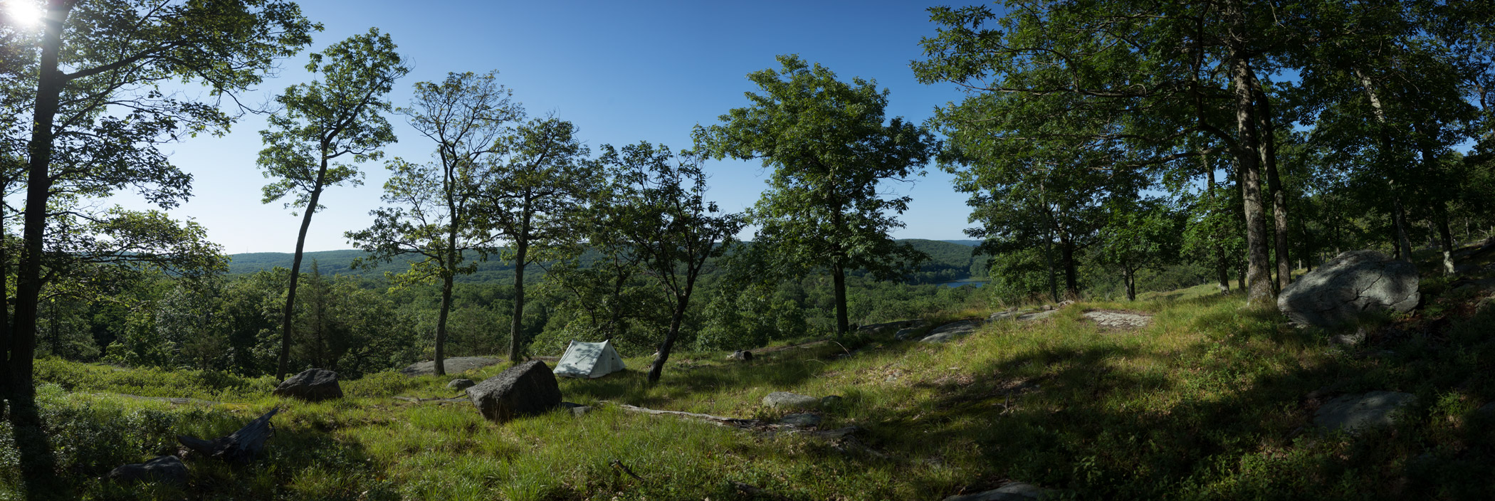
A couple years ago, I “stumbled” upon an amazing overlook in Harriman, perfect for pitching camp and waking up to a great view. It’s provided a great, easy getaway from NYC. Here are a couple photos…
My “secret” spot in Harriman State Park.My “secret” spot in Harriman State Park.
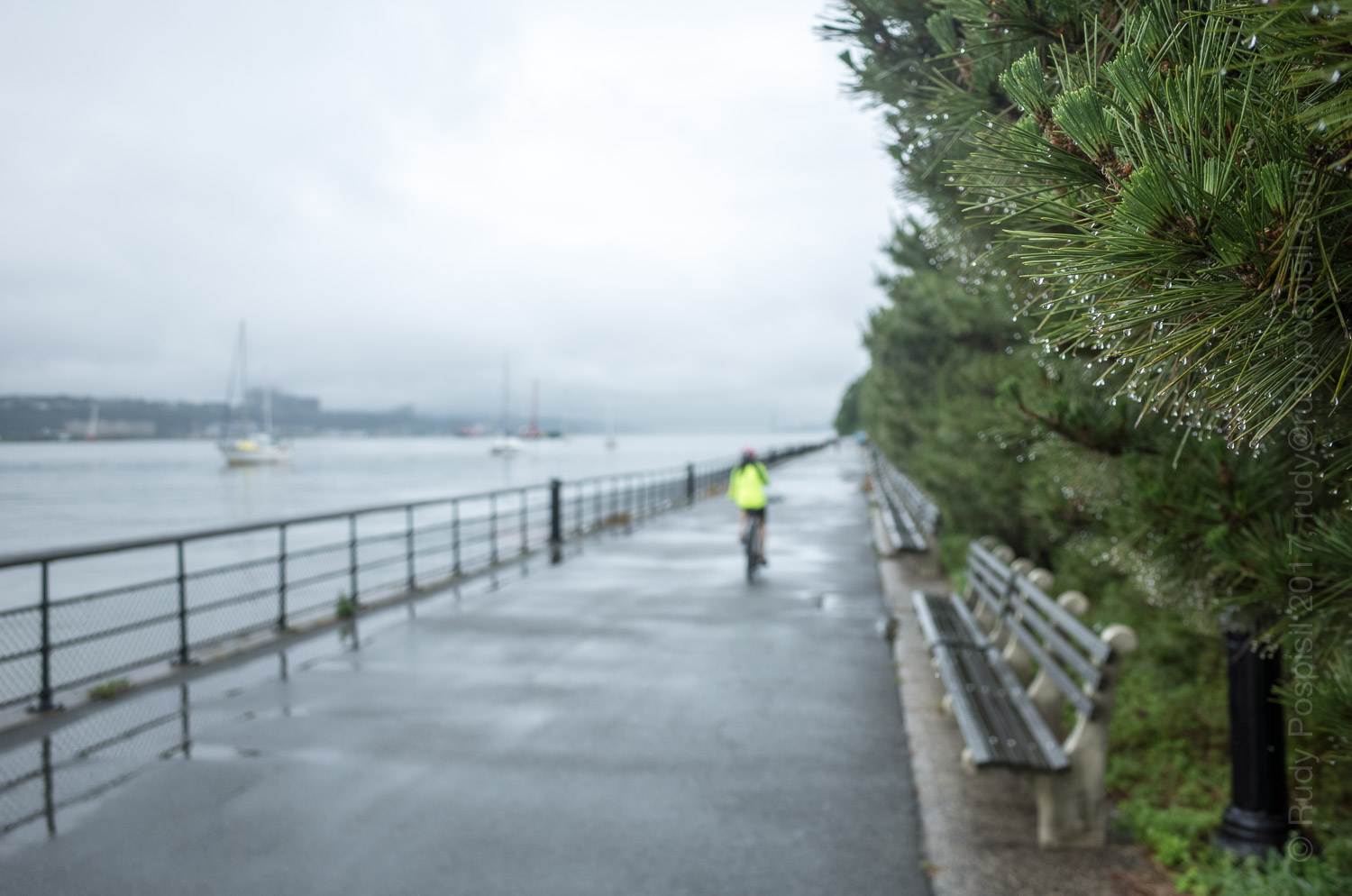
I wanted to go backpacking up in the Catskills this weekend but rain was forecasted quite a bit. I didn’t want to ride up there in the rain, change in the rain, pack up my motorcycle gear wet, and then start backpacking wet knowing that my gear would be wet the entire time. So I compromised. I had to run an errand Saturday morning and figured that I would stay in town and do a pseudo-hike by trekking on the Henry Hudson bike path from 59th street to 200th. As the crow flies, this would probably be a minimum of seven miles. With all the meandering, it was probably close to eight miles albeit with little elevation gain.
I ran my errand and then started the trek home. The rain was coming down hard. Because I was trekking urban, I took my homemade frameless Ray Jardin backpack with an umbrella tucked in the side pocket.
Rainy day hike along the New York side of the Hudson River.Looking down Pier 1 from inside Pier 1 Café on the Henry Hudson Greenway.Urban waterfalls along the Henry Hudson Greenway.Hiking past the New York City Marina along the Hudson River Greenway.Passing by the rain soaked 96th Street clay tennis courts.Finally able to get off the asphalt and pound some dirt.Water, water everywhere but not a drop to drink.Passing under the Henry Hudson Parkway.Soccer field at 144th Street, north of West Harlem Pier and the Fairway grocery store.Passing by a salt depot by the Northern Riverside Park area.Lots of parties happening in the Northern Riverside Park.Fishing in the Northern Riverside Park with the George Washington Bridge in the background.Coming upon a fellow camper along the Henry Hudson River.This confounded me. Rather than simply removing the broken glass, the city leaves it dangerously in place and simply wraps caution tape around it.Underneath the George Washington Bridge, Fort Washington Point.Passing by Inspiration Point near Fort Tryon.New York City hiking, cars whizzing by less than five feet from the path. Fort Tryon is in the background.Back home in Inwood, approximately eight miles later. The hike went from 57th Street to 200th Street.
The second mountain this year of my Catskill 3500 journey.
Arriving at the Platte Clove parking lot for the hike up the Catskill’s Indian Head Mountain.Walking from the Platte Clove parking lot to the Indian Head Mountain trailhead. Does this look like a scene from a jigsaw puzzle or what?Starting out on the trailhead. A pretty simple path.After a bit, the path starts getting rocky.After a bit, the path starts getting rocky.A very precarious walk along the edge of a cliff.Coming up on the first vista. Perfect blue skies.Coming up on the first vista. Perfect blue skies.Coming up on the first vista. Perfect blue skies.Coming up on the first vista. Perfect blue skies.Looking down the steep bit of rocks I just climbed.Coming upon another beautiful vista. There is a perfect rock slab to perch upon.Coming upon another beautiful vista. There is a perfect rock slab to perch upon.Coming upon another beautiful vista. There is a perfect rock slab to perch upon.Coming upon another beautiful vista. There is a perfect rock slab to perch upon.Let another beautiful view, this one extremely close to the summit.Let another beautiful view, this one extremely close to the summit.Let another beautiful view, this one extremely close to the summit.Heading back down Indian Head Mountain.Looking for a spot to camp.It’s been a challenge, I’m tired. Setting up the Hilleberg Unna for the night.Garmin Montana GPS elevation graph showing the ascent of Indian Head Mountain.Google Earth map showing the to and fro hike of Indian Head Mountain.Heading back to the Platte Clove parking lot, loving the level ground.Artist in Residence program.Back at the parking lot, the trusty BMW R1200GS had a good night’s sleep.Passing by a Confederate Flag on the way home. What are they doing up in Yankee territory?